East Canada Creek facts for kids
Quick facts for kids East Canada Creek |
|
|---|---|

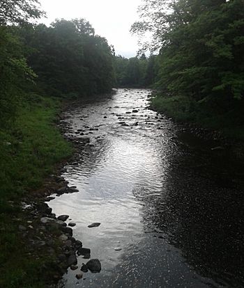
East Canada Creek upstream of Emmonsburg Road
|
|
|
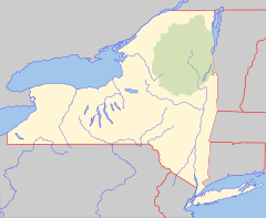
Location of the mouth of East Canada Creek
|
|
| Country | United States |
| State | New York |
| Regions |
|
| Counties | |
| Physical characteristics | |
| Main source | Northeast of Powley Place, Hamilton County, New York 43°20′18″N 74°37′36″W / 43.33833°N 74.62667°W |
| River mouth | Mohawk River East Creek, Montgomery County, New York 305 ft (93 m) 42°59′58″N 74°44′37″W / 42.99944°N 74.74361°W |
| Length | 34.6 mi (55.7 km) |
| Basin features | |
| Basin size | 289 sq mi (750 km2) |
| Tributaries |
|
East Canada Creek is a 34.6-mile-long (55.7 km) river in upstate New York, United States. It is a tributary of the Mohawk River and flows southward from New York's Adirondack Park. The name "Canada" may be derived from the St. Lawrence Iroquoian word Kanata, meaning "village"; the name may also refer to the creek's importance as a trail to Canada in colonial times.
Course
The creek is formed northeast of Powley Place in the Town of Arietta in Hamilton County, where it is created by the confluence of smaller streams. It goes on to form part of the boundary between Herkimer, Fulton, and Montgomery counties. It also flows through the Village of Dolgeville, after passing Dolgeville it enters into Kyser Lake.

All content from Kiddle encyclopedia articles (including the article images and facts) can be freely used under Attribution-ShareAlike license, unless stated otherwise. Cite this article:
East Canada Creek Facts for Kids. Kiddle Encyclopedia.


