East Amwell Township, New Jersey facts for kids
Quick facts for kids
East Amwell Township, New Jersey
|
||
|---|---|---|
|
Township
|
||

Reaville Church
|
||
|
||

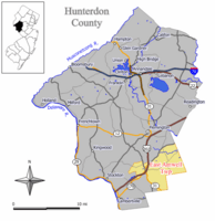
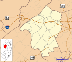
Location of East Amwell Township in Hunterdon County highlighted in yellow (right). Inset map: Location of Hunterdon County in New Jersey highlighted in black (left).
|
||

Census Bureau map of East Amwell Township, New Jersey
|
||
| Country | ||
| State | ||
| County | ||
| Incorporated | April 6, 1846 | |
| Named for | Amwell Township / Great and Little Amwell, Hertfordshire | |
| Government | ||
| • Type | Township (New Jersey) | |
| • Body | Township Committee | |
| Area | ||
| • Total | 28.56 sq mi (73.96 km2) | |
| • Land | 28.46 sq mi (73.70 km2) | |
| • Water | 0.10 sq mi (0.27 km2) 0.36% | |
| Area rank | 94th of 565 in state 8th of 26 in county |
|
| Elevation | 203 ft (62 m) | |
| Population
(2020)
|
||
| • Total | 3,917 | |
| • Estimate
(2023)
|
3,937 | |
| • Rank | 416th of 565 in state 12th of 26 in county |
|
| • Density | 137.7/sq mi (53.2/km2) | |
| • Density rank | 527th of 565 in state 24th of 26 in county |
|
| Time zone | UTC−05:00 (Eastern (EST)) | |
| • Summer (DST) | UTC−04:00 (Eastern (EDT)) | |
| ZIP Code | ||
| Area code(s) | 609 and 908 | |
| FIPS code | 3401918820 | |
| GNIS feature ID | 0882180 | |
| Website | ||
East Amwell Township is a township in Hunterdon County, in the U.S. state of New Jersey. As of the 2020 United States census, the township's population was 3,917, a decrease of 96 (−2.4%) from the 2010 census count of 4,013, which in turn reflected a decline of 442 (−9.9%) from the 4,455 counted in the 2000 census.
East Amwell Township is located in the southeastern corner of Hunterdon County where it borders both Somerset and Mercer counties, within the heart of the Amwell Valley and Raritan Valley regions. It includes the unincorporated community of Ringoes, the oldest known settlement in Hunterdon County, as well as the communities of Larison's Corner, Weert's Corner and part of Reaville.
Contents
History
Amwell Township was established by a royal patent from Queen Anne in 1708. Its territory comprised 200 square miles (520 km2) and included present day Delaware Township, Raritan Township, Readington Township, East Amwell Township and West Amwell Township and portions of Clinton, Lebanon and Tewksbury Townships. Both East Amwell Township and West Amwell Township were formed on April 6, 1846, when Amwell Township was split in two. Territory was gained in 1854 from Delaware Township, Raritan Township and West Amwell Township, and again from those same three townships in 1897. The township was named for Amwell Township, which in turn was named for Great Amwell/Little Amwell, Hertfordshire in England.
East Amwell was the location of the Lindbergh kidnapping, in which Charles Augustus Lindbergh III, was abducted from the estate owned by Charles Lindbergh and Anne Morrow Lindbergh, and was later found dead nearby.
Geography
According to the United States Census Bureau, the township had a total area of 28.56 square miles (73.96 km2), including 28.46 square miles (73.70 km2) of land and 0.10 square miles (0.27 km2) of water (0.36%).
The northern areas of East Amwell are in the Amwell Valley, while the southern sections are in The Sourlands region. The township borders Delaware Township, Raritan Township and West Amwell Township in Hunterdon County; Hopewell Township in Mercer County; and Hillsborough Township and Montgomery Township in Somerset County.
Unincorporated communities, localities and place names located partially or completely within the township include Amwell, Boss Road, Bowne, Buttonwood Corners, Cloverhill, Furmans Corner, Larisons Corners, Linvale (historically known as New Market), Reaville, Rileyville, Ringoes, Rocktown, Snydertown, Union, Unionville, Venliews Corners and Wertsville.
Demographics
| Historical population | |||
|---|---|---|---|
| Census | Pop. | %± | |
| 1850 | 1,330 | — | |
| 1860 | 1,865 | 40.2% | |
| 1870 | 1,802 | −3.4% | |
| 1880 | 1,696 | −5.9% | |
| 1890 | 1,375 | −18.9% | |
| 1900 | 1,327 | −3.5% | |
| 1910 | 1,203 | −9.3% | |
| 1920 | 1,102 | −8.4% | |
| 1930 | 1,210 | 9.8% | |
| 1940 | 1,218 | 0.7% | |
| 1950 | 1,525 | 25.2% | |
| 1960 | 1,981 | 29.9% | |
| 1970 | 2,568 | 29.6% | |
| 1980 | 3,468 | 35.0% | |
| 1990 | 4,332 | 24.9% | |
| 2000 | 4,455 | 2.8% | |
| 2010 | 4,013 | −9.9% | |
| 2020 | 3,917 | −2.4% | |
| 2023 (est.) | 3,937 | −1.9% | |
| Population sources: 1850–1920 1850–1870 1850 1870 1880–1890 1890–1910 1910–1930 1940–2000 2000 2010 2020 |
|||
2010 census
The 2010 United States census counted 4,013 people, 1,518 households, and 1,155 families in the township. The population density was 141.0 per square mile (54.4/km2). There were 1,580 housing units at an average density of 55.5 per square mile (21.4/km2). The racial makeup was 95.81% (3,845) White, 1.25% (50) Black or African American, 0.05% (2) Native American, 1.42% (57) Asian, 0.00% (0) Pacific Islander, 0.67% (27) from other races, and 0.80% (32) from two or more races. Hispanic or Latino of any race were 2.82% (113) of the population.
Of the 1,518 households, 28.7% had children under the age of 18; 67.2% were married couples living together; 6.1% had a female householder with no husband present and 23.9% were non-families. Of all households, 17.9% were made up of individuals and 6.2% had someone living alone who was 65 years of age or older. The average household size was 2.63 and the average family size was 3.01.
22.0% of the population were under the age of 18, 6.5% from 18 to 24, 18.2% from 25 to 44, 39.1% from 45 to 64, and 14.2% who were 65 years of age or older. The median age was 46.8 years. For every 100 females, the population had 106.9 males. For every 100 females ages 18 and older there were 101.0 males.
The Census Bureau's 2006–2010 American Community Survey showed that (in 2010 inflation-adjusted dollars) median household income was $105,846 (with a margin of error of +/− $12,725) and the median family income was $124,659 (+/− $16,916). Males had a median income of $87,727 (+/− $15,438) versus $53,491 (+/− $7,390) for females. The per capita income for the borough was $46,986 (+/− $4,981). About 0.8% of families and 2.1% of the population were below the poverty line, including none of those under age 18 and none of those age 65 or over.
Education
The East Amwell Township School District serves public school students in pre-kindergarten through eighth grade at East Amwell Township School. As of the 2021–22 school year, the district, comprised of one school, had an enrollment of 356 students and 41.2 classroom teachers (on an FTE basis), for a student–teacher ratio of 8.6:1.
Public school students in ninth through twelfth grades attend Hunterdon Central High School, part of the Hunterdon Central Regional High School District in central Hunterdon County, which serves students from Delaware Township, East Amwell Township, Flemington Borough, Raritan Township and Readington Township. As of the 2021–22 school year, the high school had an enrollment of 2,575 students and 225.3 classroom teachers (on an FTE basis), for a student–teacher ratio of 11.4:1. Seats on the high school district's nine-member board of education are allocated based in the population of the five constituent municipalities who participate in the school district, with one seat allocated to East Amwell Township.
Eighth grade students from all of Hunterdon County are eligible to apply to attend the high school programs offered by the Hunterdon County Vocational School District, a county-wide vocational school district that offers career and technical education at its campuses in Raritan Township and at programs sited at local high schools, with no tuition charged to students for attendance.
Transportation
As of May 2010[update], the township had a total of 68.03 miles (109.48 km) of roadways, of which 42.84 miles (68.94 km) were maintained by the municipality, 17.15 miles (27.60 km) by Hunterdon County and 8.04 miles (12.94 km) by the New Jersey Department of Transportation.
Route 31 passes through mostly along the western border with West Amwell Township. Route 179 and U.S. Route 202 pass through near Ringoes, with Route 31 becoming concurrent with U.S. 202 where they intersect.
Major county roads that go through the township are County Route 514 (along the border with Raritan) and County Route 579. The closest limited access road is Interstate 295 in neighboring Hopewell Township.
The Hopewell Project
East Amwell is home to an experimental renewable energy project called The Hopewell Project, which uses solar power to generate hydrogen that is used to provide 100% of a home's heating, cooling and electrical needs. The Hopewell Solar-Hydrogen Residence was dedicated on October 20, 2006.
Wineries
Notable people
People who were born in, residents of, or otherwise closely associated with East Amwell Township include:
- Hannah Altman (born 1995), photographer, whose artwork explores lineage, memory, ritual, and storytelling
- James Buchanan (1839–1900), represented New Jersey's 2nd congressional district from 1885 to 1893
- Matt Ioannidis (born 1994), defensive end for the Washington Football Team of the National Football League
- Charles Lindbergh (1902–1974) and Anne Morrow Lindbergh (1906–2001), aviators. The Lindbergh kidnapping occurred at the family home in East Amwell, though press reports were filed from the nearby town of Hopewell
- Andrew Maguire (born 1939), represented New Jersey's 7th congressional district from 1975 to 1981
- David Stout Manners (1808–1884), Mayor of Jersey City, New Jersey from 1852 to 1857
- Stan Ploski Jr. (born 1944), retired dirt modified racing driver
- Horace Griggs Prall (1881–1951), acting Governor of New Jersey in 1935
- Jason Read (born 1977), rower who rowed in the bow seat in the 2004 Summer Olympics gold medal-winning U.S. Men's Rowing Team Eight


