Duncansby Head facts for kids
 |
|
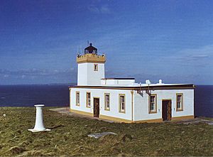
| Duncansby Head Lighthouse | |
| Location | Duncansby Head Scotland United Kingdom |
|---|---|
| Coordinates | 58°38′39″N 3°01′30″W / 58.644039°N 3.025120°W |
| Year first constructed | 1924 |
| Construction | concrete tower |
| Tower shape | square tower with balcony and lantern |
| Markings / pattern | white tower, black lantern, ochre balcony |
| Height | 11 m (36 ft) |
| Focal height | 67 m (220 ft) |
| Intensity | 596,000 cd |
| Range | 22 nmi (41 km) |
| Characteristic | Fl W 12 s |
| Admiralty number | A3558 |
| NGA number | 3016 |
| ARLHS number | SCO-062 |
Duncansby Head (Scottish Gaelic: Ceann Dhunngain or Dùn Gasbaith) is the most northeasterly part of the British mainland, slightly northeast of John o' Groats. It is located in Caithness, Highland, in north-eastern Scotland. The headland juts into the North Sea, with the Pentland Firth to its north and west and the Moray Firth to its south.
Lighthouse
The point is marked by Duncansby Head Lighthouse, built by David Alan Stevenson in 1924.
A minor public road leads from John o' Groats to Duncansby Head, which makes Duncansby Head the farthest point by road from Land's End.
The Duncansby Head Site of Special Scientific Interest includes the 6.5-kilometre (4-mile) stretch of coast south to Skirza Head. It includes the Duncansby Stacks, prominent sea stacks just off the coast.
Atomic Weapon Test
In 2016, it was reported in The Sunday Post newspaper that scientists from the Atomic Weapons Establishment in Aldemarston had proposed a nuclear weapon test on the Stacks of Duncansby in 1953, but that the prevailing wet weather was too much for contemporary electronics and the idea was shelved.

