Downtown West, Minneapolis facts for kids
Quick facts for kids
Downtown West
|
|
|---|---|
|
Neighborhood
|
|

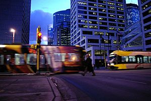
Lightrail passes through the center of Downtown Minneapolis
|
|

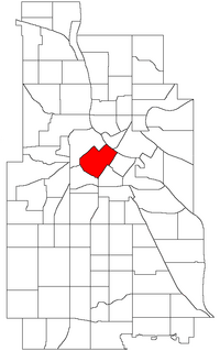
Location of Downtown West within the U.S. city of Minneapolis
|
|
| Country | United States |
| State | Minnesota |
| County | Hennepin |
| City | Minneapolis |
| Community | Central |
| Founded | 1849 |
| City Council Wards | 3, 7 |
| Area | |
| • Total | 0.759 sq mi (1.97 km2) |
| Population
(2020)
|
|
| • Total | 8,958 |
| • Density | 11,802/sq mi (4,557/km2) |
| Time zone | UTC-6 (CST) |
| • Summer (DST) | UTC-5 (CDT) |
| ZIP code |
55401, 55402, 55403, 55404, 55415, 55487
|
| Area code(s) | 612 |
| Historical population | |||
|---|---|---|---|
| Census | Pop. | %± | |
| 1980 | 3,522 | — | |
| 1990 | 3,789 | 7.6% | |
| 2000 | 4,581 | 20.9% | |
| 2010 | 5,781 | 26.2% | |
| 2020 | 8,958 | 55.0% | |
Downtown West is an official neighborhood in Minneapolis, part of the larger Central community. It is the heart of downtown Minneapolis (and Minneapolis as a whole), containing the bulk of high-rise office buildings in the city, and is what comes to mind when most Minneapolitans think of "downtown". The neighborhood is split between Wards 3 and 7 of the Minneapolis City Council, represented by Michael Rainville and Katie Cashman, respectively.
The boundaries are as follows (going in a clockwise direction): 12th Street to the southwest, 3rd Avenue North, Washington Avenue North, and Hennepin Avenue to the northwest, the Mississippi River to the northeast, and Portland Avenue, 5th Street South, and 5th Avenue South to the southeast. It is bordered by the North Loop, Nicollet Island/East Bank, Downtown East, Elliot Park, and Loring Park neighborhoods.
Downtown West is home to most of Minneapolis's most notable buildings like the Foshay Tower and IDS Center.

