Doe Run Creek (Ararat River tributary) facts for kids
Quick facts for kids Doe Run Creek |
|
|---|---|
|
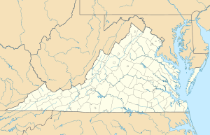
Location of Doe Run Creek mouth
|
|
| Other name(s) | Tributary to Ararat River |
| Country | United States |
| State | Virginia |
| County | Patrick |
| Physical characteristics | |
| Main source | Johnson Creek divide about 2 miles west of Groundhog Mountain peak 2,500 ft (760 m) 36°38′31″N 080°33′14″W / 36.64194°N 80.55389°W |
| River mouth | Ararat River about 1 mile northwest of The Hollow, Virginia 1,188 ft (362 m) 36°35′25″N 080°32′56″W / 36.59028°N 80.54889°W |
| Length | 3.78 mi (6.08 km) |
| Basin features | |
| Progression | south |
| River system | Yadkin River |
| Basin size | 2.63 square miles (6.8 km2) |
| Tributaries |
|
| Bridges | Logan Bluff, Youngs View Trail, Green Spring Road, Friends Mission Road |
Doe Run Creek is a 3.73 mi (6.00 km) long 1st order tributary to the Ararat River in Patrick County, Virginia.
Variant names
According to the Geographic Names Information System, it has also been known historically as:
- Doe Run Baptist Church
Course
Doe Run Creek rises on the Johnson Creek divide about 2 miles west of the Groundhog Mountain peak in Patrick County. Doe Run Creek then flows south to join the Ararat River about 1 mile northwest of The Hollow, Virginia.
Watershed
Doe Run Creek drains 2.63 square miles (6.8 km2) of area, receives about 50.5 in/year of precipitation, has a wetness index of 307.61, and is about 73% forested.

All content from Kiddle encyclopedia articles (including the article images and facts) can be freely used under Attribution-ShareAlike license, unless stated otherwise. Cite this article:
Doe Run Creek (Ararat River tributary) Facts for Kids. Kiddle Encyclopedia.


