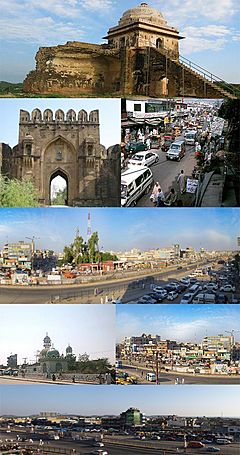
Dina facts for kids
Quick facts for kids
Dina
|
|
|---|---|
|
Immigirant city
|
|
| Dina (دینہ) | |
 |
|
| Country | |
| Province | Punjab |
| District | Jhelum District |
| Tehsil | Dina |
| Area | |
| • Total | 275 km2 (106 sq mi) |
| Population
(1998)
|
|
| • Estimate
(2008)
|
120,000 |
| Time zone | UTC+5 (PST) |
Dina (Urdu: دینہ) is a rapidly expanding commercial town in the Jhelum District of the province of Punjab, Pakistan. It is about 10 miles northwest of Jhelum City, where there is a junction with the road to the Mangla Dam and Rohtas Fort. The historic Grand Trunk Road passes through the centre of the town.
Government
In 1977, a municipal committee was established at Dina, but the town's status was changed to an administrative subdivision or tehsil of Jhelum District. The town is divided into 2 Union councils, UC 23 and UC 24.
Geography
The town is located at 33°1'60N 73°35'60E and has an altitude of 275 metres (905 ft) and has an area of about 21,880 acres (88.5 km2).
Tribes & Clans
The jatt, Ghakkars, Mughals, Gujjars, Mirzas, Kashmiri Butt and Balouch tribes have the main control over the political activities and they occupy the maximum land of Dina city.
Mohallahas Of the Dina City
- Kiyani Mohallaha
- Domeli Mohallaha
- Khalilabad Mohallaha
- Station Mohallaha
- Naya(New) Mohallaha
- Liaqat Town
- Quaid e Azam Town
- Mahsoom Mohallaha
- Islam Pura Mohallaha
- Mughal abad
- Iqbal Town
Villages
- Bara Giran
- Burha Jungla
- Boharian
- Chak Akah
- Chahmala
- Channi Gujran
- Chakyam
- Chak Daria
- Chak Hafizan
- Chittan
- Dhadhowal
- Dhowal
- Dhoke Moka
- Dhok Padhal
- Dhok Rajghan
- Dhok Ranga
- Gaggar Khurd
- Gaggar klan
- Hari
- Jandalah
- Kala Gujran
- Kantrila
- Kurlan
- Khojaki
- Khukha
- Maldev
- Mehtah
- Motah
- Mota Gharbi
- Muftian
- Nakki
- Nakodar
- Natain
- Pandori
- PirShah Wason
- Pind Jatah
- Rehana
- Rohtas
- Said Husain
- Sagri
- Tamma Ajaib

