Derwent River facts for kids
Quick facts for kids Derwent River |
|
| River | |
|
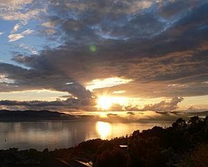
Sunrise over the Derwent River
|
|
| Country | Australia |
|---|---|
| State | Tasmania |
| Tributaries | |
| - left | Ouse River, Jordan River |
| Cities | Derwent Bridge, New Norfolk, Bridgewater, Hobart |
| Source | Lake St Clair |
| - location | Cradle Mountain-Lake St Clair National Park, Central Highlands, Tasmania, Australia |
| - elevation | 1,545 m (5,069 ft) |
| - coordinates | 42°7′12″S 146°12′37″E / 42.12000°S 146.21028°E |
| Mouth | Storm Bay |
| - location | Storm Bay, Hobart, Tasmania, Australia |
| - elevation | 0 m (0 ft) |
| - coordinates | 43°3′3″S 147°22′38″E / 43.05083°S 147.37722°E |
| Length | 239 km (149 mi) |
| Basin | 9,832 km² (3,796 sq mi) |
| Discharge | for Storm Bay |
| - average | 90 m³/s (3,178 cu ft/s) |
| - max | 140 m³/s (4,944 cu ft/s) |
| - min | 50 m³/s (1,766 cu ft/s) |
The Derwent is a river in Tasmania, Australia. It was named after the River Derwent, Cumbria, by British Commodore John Hayes who explored it in 1793. The name is Brythonic Celtic for "valley thick with oaks". John Hays placed the name "Derwent River" only in the upper part of the river. Matthew Flinders placed the name on all of the river.
The banks of the Derwent were once covered by forests and occupied by Aborigines. European settlers farmed the area and during the 20th century many dams were built on its tributaries.

All content from Kiddle encyclopedia articles (including the article images and facts) can be freely used under Attribution-ShareAlike license, unless stated otherwise. Cite this article:
Derwent River Facts for Kids. Kiddle Encyclopedia.


