Dade County, Missouri facts for kids
Quick facts for kids
Dade County
|
|
|---|---|

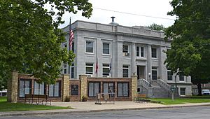
Dade County Courthouse in Greenfield
|
|

Location within the U.S. state of Missouri
|
|
 Missouri's location within the U.S. |
|
| Country | |
| State | |
| Founded | January 29, 1841 |
| Named for | Francis L. Dade |
| Seat | Greenfield |
| Largest city | Greenfield |
| Area | |
| • Total | 506 sq mi (1,310 km2) |
| • Land | 490 sq mi (1,300 km2) |
| • Water | 16 sq mi (40 km2) 3.2% |
| Population
(2020)
|
|
| • Total | 7,569 |
| • Density | 14.958/sq mi (5.776/km2) |
| Time zone | UTC−6 (Central) |
| • Summer (DST) | UTC−5 (CDT) |
| Congressional district | 4th |
Dade County is a county located in the southwest part of the U.S. state of Missouri. As of the 2020 census, the population was 7,569. Its county seat is Greenfield. The county was organized in 1841 and named after Major Francis L. Dade of Virginia, who was killed in the Second Seminole War in 1835.
Contents
Geography
According to the U.S. Census Bureau, the county has a total area of 506 square miles (1,310 km2), of which 490 square miles (1,300 km2) is land and 16 square miles (41 km2) (3.2%) is water.
Adjacent counties
- Cedar County (north)
- Polk County (northeast)
- Greene County (southeast)
- Lawrence County (south)
- Jasper County (southwest)
- Barton County (west)
Major highways
 U.S. Route 160
 Route 39
 Route 97
Demographics
| Historical population | |||
|---|---|---|---|
| Census | Pop. | %± | |
| 1850 | 4,246 | — | |
| 1860 | 7,072 | 66.6% | |
| 1870 | 8,086 | 14.3% | |
| 1880 | 12,557 | 55.3% | |
| 1890 | 17,528 | 39.6% | |
| 1900 | 18,125 | 3.4% | |
| 1910 | 15,613 | −13.9% | |
| 1920 | 14,173 | −9.2% | |
| 1930 | 11,764 | −17.0% | |
| 1940 | 11,248 | −4.4% | |
| 1950 | 9,324 | −17.1% | |
| 1960 | 7,577 | −18.7% | |
| 1970 | 6,850 | −9.6% | |
| 1980 | 7,383 | 7.8% | |
| 1990 | 7,449 | 0.9% | |
| 2000 | 7,923 | 6.4% | |
| 2010 | 7,883 | −0.5% | |
| 2020 | 7,569 | −4.0% | |
| U.S. Decennial Census 1790-1960 1900-1990 1990-2000 2010-2015 |
|||
As of the census of 2000, there were 7,923 people, 3,202 households, and 2,276 families residing in the county. The population density was 16 people per square mile (6.2 people/km2). There were 3,758 housing units at an average density of 8 units per square mile (3.1/km2). The racial makeup of the county was 97.45% White, 0.27% Black or African American, 0.71% Native American, 0.14% Asian, 0.05% Pacific Islander, 0.19% from other races, and 1.20% from two or more races. Approximately 0.85% of the population were Hispanic or Latino of any race.
There were 3,202 households, out of which 29.10% had children under the age of 18 living with them, 61.30% were married couples living together, 6.50% had a female householder with no husband present, and 28.90% were non-families. 26.50% of all households were made up of individuals, and 14.70% had someone living alone who was 65 years of age or older. The average household size was 2.44 and the average family size was 2.93.
In the county, the population was spread out, with 24.30% under the age of 18, 6.80% from 18 to 24, 24.10% from 25 to 44, 24.40% from 45 to 64, and 20.30% who were 65 years of age or older. The median age was 42 years. For every 100 females there were 95.90 males. For every 100 females age 18 and over, there were 92.50 males.
The median income for a household in the county was $29,097, and the median income for a family was $33,651. Males had a median income of $26,092 versus $18,464 for females. The per capita income for the county was $14,254. About 9.30% of families and 13.40% of the population were below the poverty line, including 17.10% of those under age 18 and 13.10% of those age 65 or over.
2020 Census
| Race | Num. | Perc. |
|---|---|---|
| White (NH) | 6,995 | 92.42% |
| Black or African American (NH) | 34 | 0.45% |
| Native American (NH) | 50 | 0.66% |
| Asian (NH) | 24 | 0.32% |
| Pacific Islander (NH) | 0 | 0% |
| Other/Mixed (NH) | 331 | 4.37% |
| Hispanic or Latino | 135 | 1.8% |
Education
Public schools
- Dadeville R-II School District – Dadeville
- Dadeville Elementary School (K-06)
- Dadeville High School (07-12)
- Everton R-III School District – Everton
- Everton Elementary School (K-05)
- Everton Middle School (06-08)
- Everton High School (09-12)
- Greenfield R-IV School District – Greenfield
- Greenfield Elementary School (PK-06)
- Greenfield High School (07-12)
- Lockwood R-I School District – Lockwood
- Lockwood Elementary School (PK-08)
- Lockwood High School (09-12)
Private schools
- Immanuel Lutheran School – Lockwood (PK-08) – Lutheran
- Faith Fellowship Christian Academy – Greenfield (PK-10) - Baptist
Public libraries
- Dade County Library
- Lockwood Public Library
Communities
Cities and towns
- Arcola
- Dadeville
- Everton
- Greenfield (county seat)
- Lockwood
- South Greenfield
Unincorporated communities
See also
 In Spanish: Condado de Dade (Misuri) para niños

