Curly Bear Mountain facts for kids
Quick facts for kids Curly Bear Mountain Mountain |
|
|---|---|

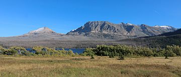
Divide Mountain at left and Curly Bear Mountain on the right
|
|
| Highest point | |
| Elevation | 8,099 ft (2,469 m) |
| Prominence | 299 ft (91 m) |
| Geography | |
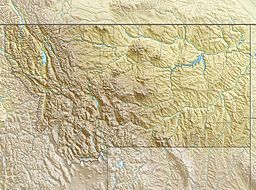
| Location | Glacier County, Montana, U.S. |
| Parent range | Lewis Range |
| Topo map | USGS Saint Mary MT |
| Climbing | |
| First ascent | Unknown |
| Easiest route | Scramble class 2-3 |
Curly Bear Mountain (8,099 feet (2,469 m)) is located in the Lewis Range, Glacier National Park in the U.S. state of Montana. Curly Bear Mountain is easily seen from the village of Saint Mary, Montana rising just west of Divide Mountain. The peak was named after Blackfoot warrior and historian Curly Bear (Kyáiyo-xusi).

All content from Kiddle encyclopedia articles (including the article images and facts) can be freely used under Attribution-ShareAlike license, unless stated otherwise. Cite this article:
Curly Bear Mountain Facts for Kids. Kiddle Encyclopedia.

