Cucao and Huillinco facts for kids
Quick facts for kids Cucao and Huillicno LakeLago Cucao y Huillinco |
|
|---|---|

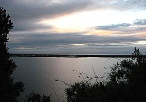
View of Cucao Lake
|
|
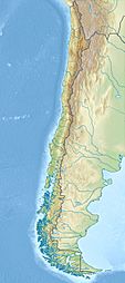
| Coordinates | 42°38′20.40″S 74°3′59.08″W / 42.6390000°S 74.0664111°W |
| Primary outflows | Cucao River, also called Desaguadero River |
| Basin countries | Chile |
| Surface area | 43.8 km2 (16.9 sq mi) |
Cucao and Huillinco are two lakes in central Chiloé Island, Chile, linked by a strait forming one hydrologic lake. The two lakes are oriented in west-east fashion cutting off the Chilean Coast Range in Chiloé Island into two ranges; Piuchén to north and Pirulil to the south. The outlet of the lakes, Desaguadero or Cucao River lies at the western end of Cucao Lake, and flows into the Pacific.
See also
 In Spanish: Lago Cucao para niños

All content from Kiddle encyclopedia articles (including the article images and facts) can be freely used under Attribution-ShareAlike license, unless stated otherwise. Cite this article:
Cucao and Huillinco Facts for Kids. Kiddle Encyclopedia.

