Crawfordville, Florida facts for kids
Quick facts for kids
Crawfordville, Florida
|
|
|---|---|
|
Census-Designated Place
|
|

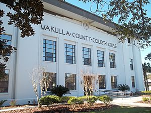
Wakulla County Courthouse
|
|

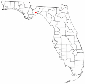
Location in Wakulla County and the state of Florida
|
|
| Country | |
| State | |
| County | Wakulla |
| Area | |
| • Census-Designated Place | 4.57 sq mi (11.83 km2) |
| • Land | 4.57 sq mi (11.83 km2) |
| • Water | 0.00 sq mi (0.00 km2) |
| • Urban | 9.72 sq mi (25.17 km2) |
| Elevation | 13 ft (4 m) |
| Population
(2020)
|
|
| • Census-Designated Place | 4,853 |
| • Density | 1,062.16/sq mi (410.14/km2) |
| • Urban | 10,124 |
| • Urban density | 1,041.67/sq mi (402.22/km2) |
| Time zone | UTC-5 (Eastern (EST)) |
| • Summer (DST) | UTC-4 (EDT) |
| ZIP codes |
32327
|
| Area code(s) | 850 |
| FIPS code | 12-15300 |
| GNIS feature ID | 2583338 |
Crawfordville is an unincorporated community, census-designated place (CDP), and county seat of Wakulla County, Florida, United States. The population at the 2020 census was 4,853, up from 3,702 at the 2010 census. It is part of the Tallahassee, Florida Metropolitan Statistical Area.
Demographics
2020 census
As of the 2020 United States census, there were 4,853 people, 1,992 households, and 1,234 families residing in the city. 569 households had children under the age of 18. 4.6% of the population was under 5 years old, 21.6% under 18 years old, and 12.9% was 65 years and over. The median age for Crawfordville was 41.8 years old. 50.2% of the population was female.
The racial makeup of the city is 82.0% White, 15.7% African American, 3.6% Native American, 1.9% Asian, 0.8% Pacific Islander, 4.5% from other races, and 8.1% from two or more races. 4.8% of the population are Hispanic or Latino of any race.
The median household income was $92,813. 1.9% of the population lived below the poverty threshold, including 3.0% of those under 18 and 5.3% of those over 65. 94.8% of the population 25 years and older had a high school degree or equivalent or higher and 20.3% of that same population had a bachelor's degree or higher. 13.5% of the population were veterans.
Transportation
Aviation
- Tallahassee International Airport (TLH) – 18.0 mi. to north
- Wakulla County Airport (2J0) – 14.8 mi. south
Major highways
 U.S. Route 319 runs north and south through town as Crawfordville Highway.
 State Road 61 enters town from the south as Crawfordville Highway (concurrent with U.S. 319), turns northeast at the southern edge of town following Shadeville Road.
Notable people
- Cecil H. Bolton, Medal of Honor recipient, was born in Crawfordville.
- Nigel Bradham, Philadelphia Eagles linebacker
- Feleipe Franks, quarterback and tight end for the Atlanta Falcons
- Alvin Hall, Financial advisor and media personality
See also
 In Spanish: Crawfordville (Florida) para niños

