County of Cavendish facts for kids
Quick facts for kids CavendishQueensland |
|||||||||||||||
|---|---|---|---|---|---|---|---|---|---|---|---|---|---|---|---|

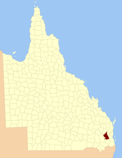
Location within Queensland
|
|||||||||||||||
|
|||||||||||||||
The County of Cavendish is a county (a cadastral division) in Queensland, Australia. Like all counties in Queensland, it is a non-functional administrative unit, that is used mainly for the purpose of registering land titles. The county includes the northern part of the Toowoomba Region and the western part of the Somerset Region. The county was officially named and bounded by the Governor in Council on 7 March 1901 under the Land Act 1897.
Parishes
Cavendish is divided into parishes, listed as follows:
| Parish | LGA | Coordinates | Towns | Parish map |
|---|---|---|---|---|
| Anduramba | Somerset | 27°12′S 152°10′E / 27.200°S 152.167°E | ||
| Avoca | Somerset | 26°37′S 152°12′E / 26.617°S 152.200°E | ||
| Biarra | Somerset | 27°06′S 152°19′E / 27.100°S 152.317°E | Toogoolawah | |
| Buaraba | Somerset | 27°22′S 152°18′E / 27.367°S 152.300°E | ||
| Clarendon | Lockyer Valley | 27°29′S 152°22′E / 27.483°S 152.367°E | ||
| Colinton | Somerset | 26°52′S 152°15′E / 26.867°S 152.250°E | Moore | |
| Cooyar | Toowoomba | 26°55′S 151°55′E / 26.917°S 151.917°E | Cooyar, Yarraman | |
| Cressbrook | Somerset | 27°07′S 152°26′E / 27.117°S 152.433°E | ||
| Crows Nest | Toowoomba | 27°15′S 152°03′E / 27.250°S 152.050°E | Crows Nest | |
| Deongwar | Somerset | 27°15′S 152°11′E / 27.250°S 152.183°E | ||
| Djuan | Toowoomba | 27°08′S 151°56′E / 27.133°S 151.933°E | Haden | |
| Emu Creek | Toowoomba | 27°00′S 152°02′E / 27.000°S 152.033°E | ||
| England | Somerset | 27°25′S 152°27′E / 27.417°S 152.450°E | Coominya, Mount Tarampa | |
| Esk | Somerset | 27°14′S 152°25′E / 27.233°S 152.417°E | Esk | |
| Eskdale | Toowoomba | 27°06′S 152°10′E / 27.100°S 152.167°E | ||
| Helidon | Lockyer Valley | 27°30′S 152°07′E / 27.500°S 152.117°E | Helidon | |
| Lockyer | Lockyer Valley | 27°30′S 152°14′E / 27.500°S 152.233°E | Grantham | |
| Murphy | Lockyer Valley | 27°27′S 152°06′E / 27.450°S 152.100°E | ||
| Nukinenda | Somerset | 27°01′S 152°11′E / 27.017°S 152.183°E | ||
| Ravensbourne | Toowoomba | 27°21′S 152°08′E / 27.350°S 152.133°E | Ravensbourne | |
| Taromeo | South Burnett | 26°49′S 152°07′E / 26.817°S 152.117°E | Benarkin, Blackbutt | 1976 |
| Wivenhoe | Somerset | 27°21′S 152°32′E / 27.350°S 152.533°E | Lake Wivenhoe |

All content from Kiddle encyclopedia articles (including the article images and facts) can be freely used under Attribution-ShareAlike license, unless stated otherwise. Cite this article:
County of Cavendish Facts for Kids. Kiddle Encyclopedia.
