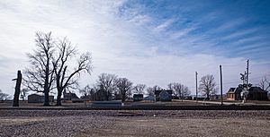
Corning, Missouri facts for kids
Quick facts for kids
Corning, Missouri
|
|
|---|---|
 |
|

Location of Corning, Missouri
|
|
| Country | United States |
| State | Missouri |
| County | Holt |
| Township | Lincoln |
| Area | |
| • Total | 0.11 sq mi (0.28 km2) |
| • Land | 0.11 sq mi (0.28 km2) |
| • Water | 0.00 sq mi (0.00 km2) |
| Elevation | 876 ft (267 m) |
| Population
(2020)
|
|
| • Total | 3 |
| • Density | 27.27/sq mi (10.57/km2) |
| Time zone | UTC-6 (Central (CST)) |
| • Summer (DST) | UTC-5 (CDT) |
| ZIP code |
64437
|
| Area code(s) | 660 |
| FIPS code | 29-16462 |
| GNIS feature ID | 2396661 |
Corning is a village in Holt County, Missouri, United States. The population was 3 at the 2020 census.
The village is named for Erastus Corning who owned sizeable shares of the Chicago, Burlington, and Quincy Railroad and who is the namesake of another Burlington railroad community Corning, Iowa.
Contents
History
Corning was laid out in 1868 on main line of the railroad between Kansas City, Missouri and Council Bluffs, Iowa (the line remains active). A post office called Corning was in operation from 1868 to 1964.
From 1882 to 1980, a spur owned by the Burlington operated between Corning and Clarinda, Iowa initially under the name of the Tarko Valley Railroad.
The village's St. John's Evangelical Lutheran Church was listed on the National Register of Historic Places in 2008.
Corning was impacted by the 2019 Midwestern U.S. floods.
Geography
According to the United States Census Bureau, the village has a total area of 0.11 square miles (0.28 km2), all land.
Demographics
| Historical population | |||
|---|---|---|---|
| Census | Pop. | %± | |
| 1880 | 221 | — | |
| 1890 | 176 | −20.4% | |
| 1900 | 240 | 36.4% | |
| 1910 | 253 | 5.4% | |
| 1920 | 255 | 0.8% | |
| 1930 | 214 | −16.1% | |
| 1940 | 269 | 25.7% | |
| 1950 | 184 | −31.6% | |
| 1960 | 128 | −30.4% | |
| 1970 | 134 | 4.7% | |
| 1980 | 126 | −6.0% | |
| 1990 | 88 | −30.2% | |
| 2000 | 21 | −76.1% | |
| 2010 | 15 | −28.6% | |
| 2020 | 3 | −80.0% | |
| U.S. Decennial Census | |||
2010 census
As of the census of 2010, there were 15 people, 8 households, and 4 families living in the village. The population density was 136.4 inhabitants per square mile (52.7/km2). There were 9 housing units at an average density of 81.8 per square mile (31.6/km2). The racial makeup of the village was 100.0% White.
There were 8 households, of which 50.0% were married couples living together and 50.0% were non-families. 25.0% of all households were made up of individuals, and 12.5% had someone living alone who was 65 years of age or older. The average household size was 1.88 and the average family size was 2.25.
The median age in the village was 60.3 years. 0.0% of residents were under the age of 18; 6.7% were between the ages of 18 and 24; 6.7% were from 25 to 44; 60.1% were from 45 to 64; and 26.7% were 65 years of age or older. The gender makeup of the village was 40.0% male and 60.0% female.
See also
 In Spanish: Corning (Misuri) para niños

