Copco Lake facts for kids
Quick facts for kids Copco Lake |
|
|---|---|
| Location | Siskiyou County, California |
| Coordinates | 41°58′46″N 122°18′13″W / 41.97944°N 122.30361°W |
| Type | reservoir |
| Primary inflows | Klamath River, Beaver Creek, Raymond Gulch, Spannaus Gulch, Snackenburg Creek, Milk Creek, Parks Canyon, Indian Creek, |
| Primary outflows | Klamath River |
| Catchment area | 4,300 square miles (11,000 km2) |
| Basin countries | United States |
| Max. length | 3 miles (4.8 km) |
| Max. width | 1,200 yards (1,100 m) |
| Surface area | 1,000 acres (400 ha) |
| Average depth | 77 feet (23 m) |
| Water volume | 77,000 acre-feet (95,000,000 m3) |
| Surface elevation | 2,605 feet (794 m) |
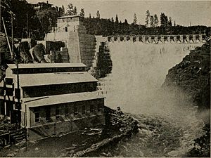
Copco Lake is an artificial lake on the Klamath River in Siskiyou County, California, near the Oregon border in the United States. The lake's waters are impounded by the Copco Number 1 Dam (National ID CA00323), which was completed in 1922. COPCO was an acronym referring to the California Oregon Power Company, which merged into Pacific Power and Light in 1961, and is now known as Pacificorp.
Copco Number 1 and Number 2 Dams are two of the four dams in the Klamath River Hydroelectric Project which have been proposed for removal. As of February 2016, the states of Oregon and California, the dam owners, federal regulators and other parties reached an agreement to remove all four dams by the year 2020, pending approval by the Federal Energy Regulatory Commission (FERC). The plan was delayed in 2020 due to conditions placed on the project by FERC. The social movement to Un-Dam the Klamath has been ongoing for 20 years.
Copco Number 1 Dam
| Copco Number 1 Dam | |
|---|---|
 |
|
| Country | United States |
| Location | Siskiyou County, California |
| Coordinates | 41°58′48″N 122°20′04″W / 41.98000°N 122.33444°W |
| Opening date | 1922 |
| Owner(s) | PacifiCorp |
| Dam and spillways | |
| Type of dam | Gravity |
| Impounds | Klamath River |
| Height | 132 feet (40 m) |
| Length | 415 feet (126 m) |
| Elevation at crest | 2,613 feet (796 m) |
| Width (crest) | 9 feet (2.7 m) |
| Dam volume | 70,312 cubic yards (53,757 m3) |
| Reservoir | |
| Creates | Copco Reservoir |
| Total capacity | 77,000 acre-feet (95,000,000 m3) |
| Catchment area | 4,300 square miles (11,000 km2) |
| Maximum length | 3 miles (4.8 km) |
| Maximum width | 1,200 yards (1,100 m) |
Copco Number 1 Dam is a gravity dam 415 feet (126 m) long and 132 feet (40 m) high, with 19.5 feet (5.9 m) of freeboard. PacifiCorp owns the dam.
Copco Number 2 Dam
Copco Number 2 Dam is a gated diversion dam located just below Dam No. 1. The dam diverts most of the flow of the river, about 2,400 to 2,500 cu ft/s (68 to 71 m3/s), through a flume and tunnels to a 27 megawatt powerhouse 1.5 miles (2.4 km) downstream, on the upstream end of Iron Gate Reservoir. The diversion bypasses a canyon section of the Klamath River that historically consisted of some steep rapids. The dam is required to maintain a minimum release of 10 cu ft/s (0.28 m3/s) to prevent this stretch from being entirely dewatered. Because it has no effective storage capacity, Dam No. 2 depends entirely on the regulated flows released from Copco Lake.
Recreation
The lake is used for kayaking, fishing, swimming, windsurfing, power boating, and sailing, and the surrounding area has facilities for picnicking and hiking.


