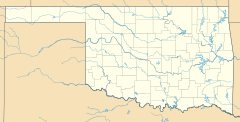
Connerville, Oklahoma facts for kids
Quick facts for kids
Connerville, Oklahoma
|
|
|---|---|
| Country | United States |
| State | Oklahoma |
| County | Johnston |
| Area | |
| • Total | 2.01 sq mi (5.20 km2) |
| • Land | 2.00 sq mi (5.19 km2) |
| • Water | 0.00 sq mi (0.01 km2) |
| Elevation | 1,014 ft (309 m) |
| Population
(2020)
|
|
| • Total | 59 |
| • Density | 29.44/sq mi (11.37/km2) |
| Time zone | UTC-6 (Central (CST)) |
| • Summer (DST) | UTC-5 (CDT) |
| ZIP code |
74836
|
| FIPS code | 40-16700 |
| GNIS feature ID | 2629914 |
Connerville is a rural unincorporated community and census-designated place on the Blue River in Johnston County, Oklahoma, United States. The post office opened August 6, 1897, in District 16 of the old Indian Territory. The ZIP Code is 74836. It is said to have been named for George B. Conner, the first postmaster.
The Census Bureau defined a census-designated place ("CDP") for Connerville in 2015; the 2010 population within the 2015 CDP boundary was 80 and contained 42 housing units. The population was 59 as of the 2020 Census.
Demographics
| Historical population | |||
|---|---|---|---|
| Census | Pop. | %± | |
| 2020 | 59 | — | |
| U.S. Decennial Census | |||

All content from Kiddle encyclopedia articles (including the article images and facts) can be freely used under Attribution-ShareAlike license, unless stated otherwise. Cite this article:
Connerville, Oklahoma Facts for Kids. Kiddle Encyclopedia.


