Conception, Missouri facts for kids
Quick facts for kids
Conception
|
|
|---|---|
| Country | United States |
| State | Missouri |
| County | Nodaway |
| Area | |
| • Total | 0.76 sq mi (1.97 km2) |
| • Land | 0.75 sq mi (1.94 km2) |
| • Water | 0.01 sq mi (0.03 km2) |
| Elevation | 1,063 ft (324 m) |
| Population
(2020)
|
|
| • Total | 111 |
| • Density | 148.00/sq mi (57.17/km2) |
| Time zone | UTC-6 (Central (CST)) |
| • Summer (DST) | UTC-5 (CDT) |
| ZIP code |
64433
|
| Area code(s) | 660 |
| FIPS code | 29-15886 |
| GNIS feature ID | 2587060 |
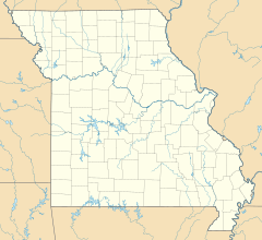
Conception is a census-designated place in eastern Nodaway County, Missouri, United States. It is located about 11 mi (18 km) southeast of Maryville on U.S. Route 136. It is very near Conception Junction (which was the rail intersection). Conception is home to Conception Abbey.
History
Conception was built up chiefly by Irish Catholics. The community was named for the Catholic dogma of Immaculate Conception. A post office called Conception has been in operation since 1864. Conception has frequently been noted on lists of unusual place names.
Demographics
| Historical population | |||
|---|---|---|---|
| Census | Pop. | %± | |
| 2020 | 111 | — | |
| U.S. Decennial Census | |||
See also
 In Spanish: Conception (Misuri) para niños

All content from Kiddle encyclopedia articles (including the article images and facts) can be freely used under Attribution-ShareAlike license, unless stated otherwise. Cite this article:
Conception, Missouri Facts for Kids. Kiddle Encyclopedia.

