Clark County, Nevada facts for kids
Quick facts for kids
Clark County
|
|||
|---|---|---|---|
|
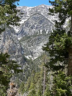
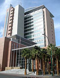
From top, left to right: Caesars Palace panorama, Red Rock Canyon National Conservation Area, Clark County Government Center, Fremont Street Experience, The Venetian, Elephant Rock at Valley of Fire State Park
|
|||
|
|||
| Motto(s):
"Together for Better"
|
|||

Location in the state of Nevada
|
|||
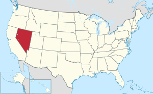
Nevada in the United States
|
|||
| Country | United States | ||
| State | Nevada | ||
| Named for | William A. Clark | ||
| County seat | Las Vegas | ||
| Largest city (population) | Las Vegas | ||
| Largest city (area) | Boulder City | ||
| Government | |||
| • Type | Council–Manager | ||
| Area | |||
| • Total | 8,061 sq mi (20,880 km2) | ||
| • Land | 7,891 sq mi (20,440 km2) | ||
| • Water | 170 sq mi (400 km2) | ||
| Lowest elevation | 492 ft (150 m) | ||
| Population
(2020)
|
|||
| • Total | 2,265,461 | ||
| • Estimate
(2023)
|
2,336,573 |
||
| • Density | 281.040/sq mi (108.510/km2) | ||
| GDP | |||
| • Total | $160.727 billion (2022) | ||
| Time zone | UTC−8 (Pacific Time Zone) | ||
| • Summer (DST) | UTC−7 (Pacific Daylight Time) | ||
| FIPS code | 003-32003 | ||
Clark County is a county located in the U.S. state of Nevada, which also comprises the Las Vegas-Henderson-North Las Vegas, NV metropolitan statistical area. The land area of Clark County is 8,061 square miles (20,880 km2), or roughly the size of New Jersey. As of the 2020 census, the population was 2,265,461. Most of the county population resides in the Las Vegas Census County Divisions, which has 2,196,623 people as of the 2020 Census. It is by far the most populous county in Nevada, and the 11th-most populous county in the United States. It covers 7% of the state's land area but holds 73% of the state's population, making Nevada the most centralized state in the United States.
Contents
History
Las Vegas, the state's most populous city, has been the county seat since its establishment. The county was formed by the Nevada Legislature by splitting off a portion of Lincoln County on February 5, 1909, and was organized on July 1, 1909. The Las Vegas Valley, a 600 sq mi (1,600 km2) basin, includes Las Vegas and other major cities and communities such as North Las Vegas, Henderson, and the unincorporated community of Paradise.
Native Americans lived in the Las Vegas Valley beginning over 10,000 years ago. Paiutes moved into the area as early as AD 700. Previously part of the Mexican Territory of Alta California, the Clark County lands were subsequently traversed by American beaver trappers. Word of their journeys inspired the New Mexican merchant Antonio Armijo in 1829 to establish the first route for mule trains and herds of livestock from Nuevo Mexico to Alta California through the area, along the Virgin and Colorado Rivers. Called the Armijo Route of the Old Spanish Trail, the route was later modified into the Main Route by the passing merchants, trappers, drovers, Ute raiders and settlers over the years by moving to a more direct route. In Clark County it was northward away from the Colorado to a series of creeks, waterholes and springs like those at Las Vegas, to which John C. Frémont added Frémont's Cutoff on his return from California to Utah in 1844.
What is now Clark County was acquired by the United States during the Mexican–American War, becoming part of the northwestern corner of New Mexico Territory. In 1847, Jefferson Hunt and other Mormon Battalion members returning to Salt Lake City from Los Angeles pioneered a wagon route through the County that became the Mormon Road. In 1849, this road became known as the "Southern Route", the winter route of the California Trail from Salt Lake City to Los Angeles during the California Gold Rush. By the mid-1850s, the route now known as the Salt Lake Road in California, and the California Road in Utah Territory, was a wagon trade route between the two. In the mid-1850s, Mormons established a Mormon Fort at Las Vegas. In the 1860s, Mormon colonies were established along the Virgin and Muddy Rivers.
All of the county was part of Mohave County, Arizona Territory, when that Territory was formed in 1863, before Nevada became a state. In 1865, it became part of Pah-Ute County, Arizona Territory. The part of Pah-Ute County north and west of the Colorado River was assigned to the new State of Nevada in 1866; however, Arizona territory fought the division until 1871. Pah-Ute County became part of Lincoln County and the westernmost part became the southernmost part of Nye County.
Clark County was named for William A. Clark, a Montana copper magnate and Democratic U.S. Senator. Clark was largely responsible for construction of the San Pedro, Los Angeles and Salt Lake Railroad through the area, contributing to the region's early development. Clark County is a major tourist destination with 150,000 hotel rooms. The Las Vegas Strip, home to many famous hotel-casinos, is not within the City of Las Vegas limits, but in unincorporated Paradise. It is, however, in the Las Vegas Valley.
Clark County is geographically coextensive with the Las Vegas MSA, a metropolitan statistical area designated by the Office of Management and Budget and used by the United States Census Bureau and other agencies for statistical purposes. Over time and influenced by climate change, droughts in Southern Nevada have been increasing in frequency and severity, putting a further strain on Clark County's and Las Vegas's water security.
Geography
The Colorado River forms the county's southeastern boundary, with Hoover Dam forming Lake Mead along much of its length. The lowest point in the state of Nevada is on the Colorado River just south of Laughlin in Clark County, where it flows out of Nevada into California and Arizona. Greater Las Vegas is a tectonic valley, surrounded by four mountain ranges, with nearby Mount Charleston being the highest elevation at 11,918 ft (3,633 m), located to the northwest. Other than the forests on Mount Charleston, the geography in Clark County is a desert. Creosote bushes are the main native vegetation, and the mountains are mostly rocky with little vegetation. The terrain slopes to the south and east. The county has an area of 20,879 km2 (8,061 sq mi), of which 20,438 km2 (7,891 sq mi) is land and 441 km2 (170 sq mi) (2.1%) is water.
Adjacent counties
- Lincoln County – north
- Mohave County, Arizona – east (observes Mountain Time)
- San Bernardino County, California – south
- Inyo County, California – northwest
- Nye County – west
National protected areas
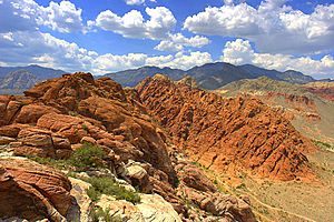
- Avi Kwa Ame National Monument
- Desert National Wildlife Refuge (part)
- Humboldt-Toiyabe National Forest (part)
- Lake Mead National Recreation Area (part)
- Moapa Valley National Wildlife Refuge
- Red Rock Canyon National Conservation Area
- Sloan Canyon National Conservation Area
- Spring Mountains National Recreation Area (part)
- Toiyabe National Forest (part)
- Tule Springs Fossil Beds National Monument (part)
Twenty official wilderness areas in Clark County are part of the National Wilderness Preservation System. Many of these are in, or partially in, one of the preceding protected areas, as shown below. Many are separate entities that are managed by the Bureau of Land Management (BLM):
- Arrow Canyon Wilderness (BLM)
- Black Canyon Wilderness (Nevada) (Lake Mead National Recreational Area [NRA])
- Bridge Canyon Wilderness (Lake Mead NRA)
- Eldorado Wilderness (Lake Mead NRA / BLM)
- Ireteba Peaks Wilderness (Lake Mead NRA / BLM)
- Jimbilnan Wilderness (Lake Mead NRA)
- Jumbo Springs Wilderness (BLM)
- La Madre Mountain Wilderness (BLM / Toiyabe National Forest [NF])
- Lime Canyon Wilderness (BLM)
- Meadow Valley Range Wilderness (BLM) mostly in Lincoln County, Nevada
- Mormon Mountains Wilderness (BLM) mostly in Lincoln County, Nevada
- Mount Charleston Wilderness (Toiyabe NF / BLM)
- Muddy Mountains Wilderness (BLM / Lake Mead NRA)
- Nellis Wash Wilderness (Lake Mead NRA)
- North McCullough Wilderness (part of Sloan Canyon NCA, which is managed by BLM)
- Pinto Valley Wilderness (Lake Mead NRA)
- Rainbow Mountain Wilderness (BLM / Toiyabe NF)
- South McCullough Wilderness (BLM)
- Spirit Mountain Wilderness (Lake Mead NRA / BLM)
- Wee Thump Joshua Tree Wilderness (BLM)
Environmental factors
Clark County has diverse desert flora and fauna, including higher-elevation mountain areas, the desert floor, and the Colorado River/Lake Mead ecosystems. Variations in diurnal temperature as well as seasonal swings in temperature create demanding adaptation elements on the species of this county. Population expansion, especially since 1970, has placed additional pressure on species in the area.
Correspondingly, air quality levels prior to the 1960s were in a favorable range, but the proliferation of automobiles with the human population expansion created circumstances where some federal air quality standards were violated starting in the 1980s.
To plan for the wave of development forecast by 1980, Clark County embarked on a regional environmental impact assessment funded by a federal Section 208 program, with Sedway Cooke conducting the planning work and Earth Metrics performing environmental analysis. This endeavor projected population growth, land use changes and environmental impacts.
To prevent the loss of federal funds due to unacceptable dust levels in the Las Vegas valley, in 2003 the Nevada Air Quality Management division (under direction of Clark County officials) created the "Don't Be a Dusthole" campaign. The campaign successfully raised awareness of dust pollution in the Las Vegas Valley, quantifiably reducing pollutants and preserving ongoing federal funding.
The Apex Landfill, at 2,200 acres (890 ha), is the nation's largest landfill. Republic Services owns and operates the landfill.
Earthquake hazards
Nevada is the third most seismically active state in the U.S. (after Alaska and California); the United States Geological Survey has estimated that over the next 50 years, Clark County has a 10–20% chance of a (moment magnitude) M6.0 or greater earthquake occurring within 50 km (31 mi) of Las Vegas.
Demographics
| Historical population | |||
|---|---|---|---|
| Census | Pop. | %± | |
| 1910 | 3,321 | — | |
| 1920 | 4,859 | 46.3% | |
| 1930 | 8,532 | 75.6% | |
| 1940 | 16,414 | 92.4% | |
| 1950 | 48,289 | 194.2% | |
| 1960 | 127,016 | 163.0% | |
| 1970 | 273,288 | 115.2% | |
| 1980 | 463,087 | 69.5% | |
| 1990 | 741,459 | 60.1% | |
| 2000 | 1,375,765 | 85.5% | |
| 2010 | 1,951,269 | 41.8% | |
| 2020 | 2,265,461 | 16.1% | |
| 2023 (est.) | 2,336,573 | 19.7% | |
| US Decennial Census 1790–1960 1900–1990 1990–2000 2010–2018 2022 estimate |
|||
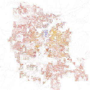
| Race / Ethnicity | Pop 2010 | Pop 2020 | % 2010 | % 2020 |
|---|---|---|---|---|
| White alone (NH) | 935,955 | 892,802 | 47.97% | 39.41% |
| Black or African American alone (NH) | 194,821 | 275,002 | 9.98% | 12.14% |
| Native American or Alaska Native alone (NH) | 8,732 | 8,487 | 0.45% | 0.37% |
| Asian alone (NH) | 165,121 | 231,972 | 8.46% | 10.24% |
| Pacific Islander alone (NH) | 12,474 | 18,877 | 0.64% | 0.83% |
| Some Other Race alone (NH) | 3,719 | 12,890 | 0.19% | 0.57% |
| Mixed Race/Multi-Racial (NH) | 61,803 | 124,015 | 3.17% | 5.48% |
| Hispanic or Latino (any race) | 568,644 | 701,416 | 29.14% | 30.96% |
| Total | 1,951,269 | 2,265,461 | 100.00% | 100.00% |
Note: the US Census treats Hispanic/Latino as an ethnic category. This table excludes Latinos from the racial categories and assigns them to a separate category. Hispanics/Latinos can be of any race.
2022 American Community Survey
In 2022, there were 857,362 households and 2,322,985 people living in Clark County. By race and ethnicity, the population was 37.6% non-Hispanic white, 32.6% Hispanic or Latino of any race, 11.7% black, 10.7% Asian, 5.9% multiracial, 0.7% Pacific Islander, 0.3% Native American, and 0.6% some other race.
The largest ancestries in the county were Mexican (23.2%), German (7.4%), Filipino (6.8%), English (6.8%), Irish (6.2%), and Italian (4.5%).
2010 census
As of the 2010 United States Census, there were 1,951,269 people, 715,365 households, and 467,916 families in the county. The population density was 247.3 inhabitants per square mile (95.5/km2). There were 840,343 housing units at an average density of 106.5 per square mile (41.1/km2). The racial makeup of the county was 60.9% White, 13.5% Black or African American, 8.7% Asian, 0.7% Pacific islander, 0.7% American Indian, 10.5% from other races, and 5.1% from two or more races. Those of Hispanic or Latino origin made up 29.1% of the population. In terms of European/white ancestries, 11.7% were German, 9.1% were Irish, 7.6% were English, 6.3% were Italian, and 2.7% were American.
Of the 715,365 households, 34.9% had children under the age of 18 living with them, 45.0% were married couples living together, 13.5% had a female householder with no husband present, 34.6% were non-families, and 25.3% of all households were made up of individuals. The average household size was 2.70 and the average family size was 3.26. The median age was 35.5 years.
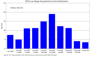
The median income for a household in the county was $56,258 and the median income for a family was $63,888. Males had a median income of $43,693 versus $35,324 for females. The per capita income for the county was $27,422. About 8.7% of families and 11.7% of the population were below the poverty line, including 16.9% of those under age 18 and 7.6% of those age 65 or over.
Economy

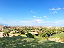
The county is home to many gaming-related companies including Golden Entertainment, American Casino & Entertainment Properties, Bally Technologies, Cannery Casino Resorts, The Majestic Star Casino, LLC, Ameristar Casinos, Archon Corporation, Boyd Gaming, Las Vegas Sands, MGM Resorts International, Wynn Resorts, DBT Online Inc., Two Plus Two Publishing, Gambler's Book Shop / GBC Press, Station Casinos, Millennium Management Group, Navegante Group, Pinnacle Entertainment and Tropicana Entertainment.
Largest employers
According to data collected by the Research and Analysis Bureau of the Nevada Department of Employment, Training and Rehabilitation, Clark County's largest employers, both public and private employers, as reported in the fourth quarter of 2012:
30,000 to 39,999 employees
- Clark County School District
5,000 to 10,000 employees
- Clark County Government
- Nellis Air Force Base
- Wynn Las Vegas
- Bellagio
- MGM Grand Las Vegas
- Aria Resort & Casino
- Mandalay Bay Resort and Casino
- Caesars Palace
- Las Vegas Metropolitan Police Department
- University of Nevada, Las Vegas
2,500 to 4,999
- The Venetian Las Vegas
- The Mirage
- The Cosmopolitan of Las Vegas
- University Medical Center of Southern Nevada
- The Palazzo
- Encore Las Vegas
- Flamingo Las Vegas
- Southwest Airlines
- City of Las Vegas municipal Government
- Paris Las Vegas
Gaming areas
The State of Nevada divides the state into several gaming districts. Accordingly, the Clark County is divided into the following reporting districts:
- Boulder Strip: This region includes 33 casinos on Boulder Highway. Casinos within the Henderson city limits are included as well, such as Green Valley Ranch, Sunset Station, The Pass, and Jokers Wild.
- Downtown: There are 19 casinos in this reporting area.
- LV Strip: This region is composed of all the casinos on Las Vegas Boulevard, from The Stratosphere at the north end to Mandalay Bay on the south end. Also included are resorts near this area, such as The Rio, South Point, and the Virgin; and Harry Reid International Airport (formerly McCarran Airport).
- North Las Vegas: This region has 11 casinos and includes the Cannery, Jerry's Nugget, and the Santa Fe Station.
- Laughlin: The casinos in Laughlin.
- Mesquite: The casinos in Mesquite.
- Balance of County: As of 2008, there are 66 casinos in this category that includes casinos at Lake Las Vegas, Jean, Primm, the Railroad Pass and Hacienda casinos, along with other casinos that do not fit any other category such as Arizona Charlie's Decatur, Gold Coast, The Orleans, The Palms, Suncoast, Rampart, and Red Rock Resort Spa and Casino
Parks and recreation
Education
The Clark County School District serves all of Clark County, with 228 elementary schools, 59 middle schools, and 54 high schools being the fifth largest in the country. Student enrollment in 2014 was 324,093.
Colleges serving the area are University of Nevada, Las Vegas (UNLV), College of Southern Nevada, Nevada State University, Roseman University of Health Sciences, and Touro University Nevada.
Transportation
Public transit
Public transit service throughout Clark County is provided by RTC Transit, which is a subsidiary of the Regional Transportation Commission of Southern Nevada. RTC Transit operates The Deuce Bus rapid transit service between Downtown Las Vegas and the Las Vegas Strip.
Major highways
 Interstate 11
 Interstate 15
 Interstate 215
 U.S. Route 93
 U.S. Route 93 Business (Boulder City, Nevada)
 U.S. Route 95
 U.S. Route 95 Business (Las Vegas)
 State Route 146
 State Route 147
 State Route 156
 State Route 157
 State Route 158
 State Route 159
 State Route 160
 State Route 161
 State Route 163
 State Route 164
 State Route 165
 State Route 168
 State Route 169
 State Route 170
 State Route 171
 State Route 172
 State Route 173
 State Route 562
 State Route 564
 State Route 573
 State Route 574
 State Route 578
 State Route 579
 State Route 582
 State Route 592
 State Route 593
 State Route 595
 State Route 596
 State Route 599
 State Route 602
 State Route 604
 State Route 610
 State Route 612
 State Route 613
 County Route 215
Rail
- Las Vegas Monorail
Clark County previously had Amtrak service on the Desert Wind, which served Las Vegas station until it stopped service in 1997. Las Vegas and Laughlin are still served by Amtrak Thruway service which connects to the Southwest Chief.
Resort trams
- Aria Express
- Mandalay Bay Tram
- The Mirage-Treasure Island Tram
Communities
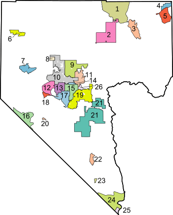
Bracketed number refers to location on map, right
Cities
- Boulder City (21)
- Henderson (19)
- Las Vegas (10) (county seat)
- Mesquite (4)
- North Las Vegas (9)
Census-designated places
- Blue Diamond (18)
- Bunkerville (5)
- Cal-Nev-Ari (23)
- Enterprise (17)
- Goodsprings (20)
- Indian Springs (6)
- Laughlin (24)
- Moapa Town (1)
- Moapa Valley (3)
- Mount Charleston (7)
- Nelson
- Paradise (15)
- Sandy Valley (16)
- Searchlight (22)
- Spring Valley (13)
- Summerlin South (12)
- Sunrise Manor (11)
- Whitney (formerly East Las Vegas) (26)
- Winchester (14)
Air Force bases
- Creech Air Force Base
- Nellis Air Force Base
Unincorporated communities
- Arden (former CDP)
- Cactus Springs
- Cottonwood Cove
- Coyote Springs (planned)
- Crescent
- Crystal (former CDP)
- Fort Mojave Indian Reservation (former CDP) (25)
- Glendale (former CDP)
- Jean
- Logandale
- Las Vegas Indian Colony (8)
- Moapa River Indian Reservation (2)
- Mountain Springs
- Overton
- Primm
- Roach
- Sloan
- Summerlin
- Sutor
- Vegas Creek (former CDP)
See also
 In Spanish: Condado de Clark (Nevada) para niños


