Churup facts for kids
Quick facts for kids Churup |
|
|---|---|
| Tsurup | |

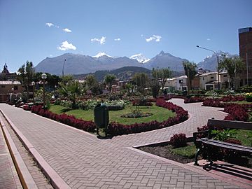
Vallunaraju and Ranrapalca (both snow-covered), Rima Rima and Churup (on the right) as seen from Huaraz
|
|
| Highest point | |
| Elevation | 5,493 m (18,022 ft) |
| Geography | |
| Location | Peru, Ancash Region |
| Parent range | Andes, Cordillera Blanca |
| Climbing | |
| First ascent | 1-1954 via N.W. side: S. rock face-1962: S.W. face-1972: Variant S.W. face direct-1982: S.W. face (new route)-1983 |
Churup or Tsurup (possibly from Ancash Quechua) is a mountain in the Cordillera Blanca in the Andes of Peru, about 5,495 metres (18,028 ft) high. It is situated in the Ancash Region, Huaraz Province, Independencia District, north-east of Huaraz. Churup is situated south of the mountain Ranrapalca, between the Rima Rima in the north-west and Collapaco and Huamashraju in the south-east, at the entrance to the Quilcayhuanca valley. Lake Churup lies at the foot of the mountain.
Gallery
See also
 In Spanish: Churup para niños

All content from Kiddle encyclopedia articles (including the article images and facts) can be freely used under Attribution-ShareAlike license, unless stated otherwise. Cite this article:
Churup Facts for Kids. Kiddle Encyclopedia.


