Churchs Ferry, North Dakota facts for kids
Quick facts for kids
Churchs Ferry, North Dakota
|
|
|---|---|

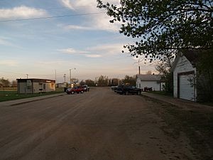
Street in Churchs Ferry
|
|

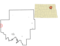
Location of Churchs Ferry, North Dakota
|
|
| Country | United States |
| State | North Dakota |
| County | Ramsey |
| Founded | 1883 |
| Unincorporated (dissolved) | September 30, 2022 |
| Area | |
| • Total | 0.43 sq mi (1.12 km2) |
| • Land | 0.43 sq mi (1.12 km2) |
| • Water | 0.00 sq mi (0.00 km2) |
| Elevation | 1,450 ft (442 m) |
| Population
(2020)
|
|
| • Total | 9 |
| • Estimate
(2022)
|
11 |
| • Density | 20.83/sq mi (8.04/km2) |
| Time zone | UTC-6 (CST) |
| • Summer (DST) | UTC-5 (CDT) |
| ZIP code |
58325
|
| Area code(s) | 701 |
| FIPS code | 38-14140 |
| GNIS feature ID | 2831213 |
Churchs Ferry is an unincorporated community in Ramsey County, North Dakota, United States that has been impacted by the expansion of nearby Devils Lake. The population was 9 at the 2020 census.
Churchs Ferry was a city from its founding in 1883 until September 2022 when the town unincorporated and was turned over to Ramsey County.
History
Devils Lake began rising in the early 1990s, and more than 400 homes around the lake have been relocated or destroyed. This includes much of the community of Churchs Ferry, one of two municipalities that have been bought out by government agencies. The other is Penn, although some people remain in both communities.
Devils Lake keeps getting larger as its outlet (Tolna Coulee) is significantly higher than the rest of the lake. In the 1880s, the lake was large enough that a man by the name of Irvine Church once operated a ferry in the area (hence the town's name), but by 1940, the lake had all but dried out. The lake is now growing back towards its maximum size again.
On January 10, 2012, Churchs Ferry residents voted 5 to 2 to remain an incorporated town.
On June 14, 2022, the town's 6 remaining residents voted to dissolve the city with a 5–1 vote. The city dissolved on September 1, 2022 with Paul Christenson being the last mayor of Churchs Ferry.
Geography
According to the United States Census Bureau, the city has a total area of 0.43 square miles (1.11 km2), all land.
Demographics
| Historical population | |||
|---|---|---|---|
| Census | Pop. | %± | |
| 1900 | 264 | — | |
| 1910 | 457 | 73.1% | |
| 1920 | 353 | −22.8% | |
| 1930 | 295 | −16.4% | |
| 1940 | 244 | −17.3% | |
| 1950 | 223 | −8.6% | |
| 1960 | 161 | −27.8% | |
| 1970 | 139 | −13.7% | |
| 1980 | 139 | 0.0% | |
| 1990 | 118 | −15.1% | |
| 2000 | 77 | −34.7% | |
| 2010 | 12 | −84.4% | |
| 2020 | 9 | −25.0% | |
| 2022 (est.) | 11 | −8.3% | |
| U.S. Decennial Census 2020 Census |
|||
2010 census
As of the census of 2010, there were 12 people, 5 households, and 5 families residing in the city. The population density was 27.9 inhabitants per square mile (10.8/km2). There were 5 housing units at an average density of 11.6 per square mile (4.5/km2). The racial makeup of the city was 100.0% White.
There were 5 households, of which 20.0% had children under the age of 18 living with them and 100.0% were married couples living together. 0.0% of all households were made up of individuals. The average household size was 2.40 and the average family size was 2.40.
The median age in the city was 48.5 years. 8.3% of residents were under the age of 18; 8.3% were between the ages of 18 and 24; 25% were from 25 to 44; 58.4% were from 45 to 64; and 0.0% were 65 years of age or older. The gender makeup of the city was 50.0% male and 50.0% female.
Transportation
Amtrak’s Empire Builder, which operates between Seattle/Portland and Chicago, passes through the town on BNSF tracks, but makes no stop. The nearest station is located in Devils Lake, 20 miles (32 km) to the southeast.
Education
It is in the Leeds School District.
See also
 In Spanish: Churchs Ferry para niños

