Chiquilistlán facts for kids
Quick facts for kids
Chiquilistlán
|
|
|---|---|
|
Municipality and town
|
|
 |
|

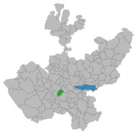
Municipality location in Jalisco
|
|
| Country | |
| State | Jalisco |
| Area | |
| • Total | 297.4 km2 (114.8 sq mi) |
| • Town | 2.56 km2 (0.99 sq mi) |
| Population
(2020 census)
|
|
| • Total | 5,983 |
| • Density | 20.118/km2 (52.105/sq mi) |
| • Town | 4,299 |
| • Town density | 1,679/km2 (4,349/sq mi) |
| Time zone | UTC-6 (Central (US Central)) |
| • Summer (DST) | UTC-5 (Central (US Central)) |
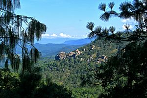
Chiquilistlán is a small town in the Mexican state of Jalisco. It is located in the Sierra Tapalpa mountains, at the foot of a hill called Chiquilichi, some 75 kilometres to the south-west of state capital Guadalajara.
Chiquilistlán is a municipal seat, serving as the administrative centre for the surrounding municipality (municipio) of the same name.
Towns in the municipality
The municipality has 27 towns; the most important ones are: Chiquilistlán (municipal seat), Jalpa (delegation), San José de la Peña, Comala, Cofradía de Jalpa, Los Llanitos, El Agostadero, El Limoncito, Capula, Citala, Almazalte, Limoncito, San Cristóbal, Guamúchil, Milpillas, Moralete, Agua Delgada, El Realito, El Mortero, Churinzio, and La Mora.

All content from Kiddle encyclopedia articles (including the article images and facts) can be freely used under Attribution-ShareAlike license, unless stated otherwise. Cite this article:
Chiquilistlán Facts for Kids. Kiddle Encyclopedia.

