Chico, Washington facts for kids
Quick facts for kids
Chico, Washington
|
|
|---|---|
| Country | United States |
| State | Washington |
| County | Kitsap |
| Area | |
| • Total | 2.29 sq mi (5.93 km2) |
| • Land | 2.29 sq mi (5.93 km2) |
| • Water | 0 sq mi (0.0 km2) |
| Elevation | 40 ft (10 m) |
| Population
(2020)
|
|
| • Total | 2,723 |
| • Density | 1,189.3/sq mi (459.2/km2) |
| Time zone | UTC-8 (Pacific (PST)) |
| • Summer (DST) | UTC-7 (PDT) |
| ZIP code |
98312
|
| Area code(s) | 360 |
| FIPS code | 53-12175 |
| GNIS feature ID | 1512090 |
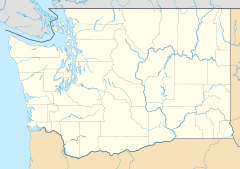
Chico is an unincorporated community and census-designated place (CDP) in Kitsap County, Washington, United States. Named in 1889 for a local Indian, Chico is located on the Dyes Inlet waterfront, south of Silverdale. At the 2020 census the community had a population of 2,723.
| Historical population | |||
|---|---|---|---|
| Census | Pop. | %± | |
| 2010 | 2,259 | — | |
| 2020 | 2,723 | 20.5% | |
| Sources: | |||
Geography
Chico is in central Kitsap County, bordered to the north by Silverdale and to the south by the Erlands Point and Kitsap Lake CDPs. It is bordered to the east by Dyes Inlet, a tidal water body that connects to Puget Sound via Port Washington Narrows through Bremerton, then via the strait of Port Orchard. It is bordered to the west by Camp Wesley Harris and Newberry Hill Heritage Park. The northern border is Newberry Hill Road, which separates Chico from Silverdale. Chico Creek forms the southern boundary with Erlands Point and Kitsap Lake to the south. Washington State Route 3 runs through the community, leading north 19 miles (31 km) to Port Gamble and south 4 miles (6 km) to the western side of Bremerton.
According to the U.S. Census Bureau, the Chico CDP has an area of 2.3 square miles (5.9 km2), all of it land.
See also
 In Spanish: Chico (Washington) para niños


