Chickasha Lake facts for kids
Quick facts for kids Chickasha Lake |
|
|---|---|
| Location | Caddo County, Oklahoma |
| Coordinates | 35°08′28″N 98°08′20″W / 35.141°N 98.139°W |
| Type | Reservoir |
| Etymology | Named for city of Chickasha, Oklahoma |
| Primary inflows | Spring Creek |
| Primary outflows | Spring Creek |
| Built | 1958 |
| Surface area | 2,068.6 acres (8.371 km2) |
| Average depth | 16.65 feet (5.07 m) |
| Max. depth | 38.2 feet (11.6 m) |
| Water volume | 41,080 acre-feet (50,670,000 m3) |
| Shore length1 | 10 miles (16 km) |
| Surface elevation | 1,192 feet (363 m) |
| Settlements | Chickasha, Oklahoma; Verden, Oklahoma |
| 1 Shore length is not a well-defined measure. | |
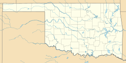
Chickasha Lake is a man-made reservoir in the central part of the state of Oklahoma. Located on Spring Creek in Caddo County, Oklahoma, it was completed in 1958. The main purposes were supplying water (especially to the city of Chickasha) and for recreation. The lake is reported to be 9 miles (14 km) west of Chickasha, and is operated by that city.
The 2011 survey showed that the lake has a surface area of 2,068.6 acres (8.371 km2) a capacity of 41,080 acre-feet (50,670,000 m3) of water when filled to an elevation of 1,192 feet (363 m). The mean depth was 16.65 feet (5.07 m) and the maximum depth was 38.2 feet (11.6 m). It also has 10 miles of shoreline.
In 2014, Chickasha announced an agreement to sell water from the lake to drillers of oil wells in the vicinity. It was revealed that the city uses Fort Cobb Reservoir as its primary source of water, but needed additional funding to repair and replace other water-related facilities in Chickasha.


