Chestnut Township, Knox County, Illinois facts for kids
Quick facts for kids
Chestnut Township
|
|
|---|---|

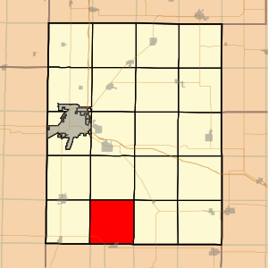
Location in Knox County
|
|

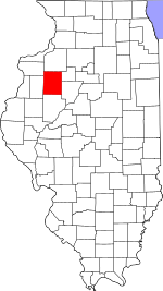
Knox County's location in Illinois
|
|
| Country | |
| State | |
| County | Knox |
| Established | November 2, 1852 |
| Area | |
| • Total | 36.18 sq mi (93.7 km2) |
| • Land | 36.18 sq mi (93.7 km2) |
| • Water | 0 sq mi (0 km2) 0% |
| Elevation | 676 ft (206 m) |
| Population
(2010)
|
|
| • Estimate
(2016)
|
246 |
| • Density | 7/sq mi (3/km2) |
| Time zone | UTC-6 (CST) |
| • Summer (DST) | UTC-5 (CDT) |
| ZIP codes |
61410, 61436, 61458, 61474, 61544
|
| FIPS code | 17-095-13217 |
Chestnut Township is one of twenty-one townships in Knox County, Illinois, United States. As of the 2010 census, its population was 253 and it contained 121 housing units.
Contents
Geography
According to the 2010 census, the township has a total area of 36.18 square miles (93.7 km2), all land.
Cities, towns, villages
- London Mills (northeast quarter)
Unincorporated towns
- Hermon at 40°45′25″N 90°19′11″W / 40.756983°N 90.319848°W
(This list is based on USGS data and may include former settlements.)
Extinct towns
- Bridgeport at 40°44′36″N 90°14′13″W / 40.743372°N 90.237068°W
- Burnside at 40°46′10″N 90°16′24″W / 40.769483°N 90.273458°W
(These towns are listed as "historical" by the USGS.)
Cemeteries
The township contains these four cemeteries: Elias Bragg, Harper, Hermon Christian and Hermon Methodist.
Airports and landing strips
- Davies Landing Strip
Demographics
| Historical population | |||
|---|---|---|---|
| Census | Pop. | %± | |
| 2016 (est.) | 246 | ||
| U.S. Decennial Census | |||
School districts
- Abingdon Community Unit School District 217
- Knoxville Community Unit School District 202
- Spoon River Valley Community Unit School District 4
See also
 In Spanish: Municipio de Chestnut para niños

All content from Kiddle encyclopedia articles (including the article images and facts) can be freely used under Attribution-ShareAlike license, unless stated otherwise. Cite this article:
Chestnut Township, Knox County, Illinois Facts for Kids. Kiddle Encyclopedia.
