Chesterfield, South Carolina facts for kids
Quick facts for kids
Chesterfield, South Carolina
|
||
|---|---|---|

Mount Tabor United Methodist Church, pictured in August 2012
|
||
|
||
| Nickname(s):
The Heart of the Carolinas
|
||

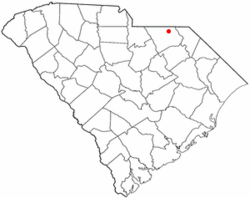
Location of Chesterfield, South Carolina
|
||
| Country | ||
| State | ||
| County | ||
| Area | ||
| • Total | 4.08 sq mi (10.56 km2) | |
| • Land | 4.08 sq mi (10.56 km2) | |
| • Water | 0.00 sq mi (0.00 km2) | |
| Elevation | 292 ft (89 m) | |
| Population
(2020)
|
||
| • Total | 1,357 | |
| • Density | 332.68/sq mi (128.45/km2) | |
| Time zone | UTC-5 (Eastern (EST)) | |
| • Summer (DST) | UTC-4 (EDT) | |
| ZIP code |
29709
|
|
| Area code(s) | 843, 854 | |
| FIPS code | 45-14140 | |
| GNIS feature ID | 1231164 | |
Chesterfield is a town in Chesterfield County, South Carolina, United States. The population was 1,357 as of the 2020 census. It is the county seat of Chesterfield County, and least populous of all South Carolina county seats.
History
The East Main Street Historic District, Dr. Thomas E. Lucas House, and West Main Street Historic District are listed on the National Register of Historic Places, supervised by the National Park Service of the U.S. Department of the Interior.
Geography
Chesterfield is located in northeastern Chesterfield County at 34°44′1″N 80°5′20″W / 34.73361°N 80.08889°W (34.733626, -80.088945). According to the United States Census Bureau, the town has a total area of 4.1 square miles (10.5 km2), all land.
South Carolina Highway 9 passes through the town, leading east 12 miles (19 km) to Cheraw and west 19 miles (31 km) to Pageland. South Carolina Highway 145 crosses SC 9 near the center of town, leading southwest 21 miles (34 km) to McBee and northeast 10 miles (16 km) to Morven, North Carolina. South Carolina Highway 102 leads south from Chesterfield 12 miles (19 km) to Patrick.
Demographics
| Historical population | |||
|---|---|---|---|
| Census | Pop. | %± | |
| 1900 | 308 | — | |
| 1910 | 618 | 100.6% | |
| 1920 | 856 | 38.5% | |
| 1930 | 1,030 | 20.3% | |
| 1940 | 1,263 | 22.6% | |
| 1950 | 1,530 | 21.1% | |
| 1960 | 1,532 | 0.1% | |
| 1970 | 1,667 | 8.8% | |
| 1980 | 1,432 | −14.1% | |
| 1990 | 1,373 | −4.1% | |
| 2000 | 1,318 | −4.0% | |
| 2010 | 1,472 | 11.7% | |
| 2020 | 1,357 | −7.8% | |
| U.S. Decennial Census | |||
2020 census
| Race | Num. | Perc. |
|---|---|---|
| White (non-Hispanic) | 882 | 65.0% |
| Black or African American (non-Hispanic) | 384 | 28.3% |
| Native American | 3 | 0.22% |
| Asian | 6 | 0.44% |
| Other/Mixed | 64 | 4.72% |
| Hispanic or Latino | 18 | 1.33% |
As of the 2020 United States census, there were 1,357 people, 571 households, and 406 families residing in the town.
Education
Chesterfield has a public library, a branch of the Chesterfield County Library System.
Geology
The "great syenite dyke" extends from Hanging Rock through Taxahaw to the Brewer and Edgeworth mine in Chesterfield.
See also
 In Spanish: Chesterfield (Carolina del Sur) para niños

