Quick facts for kids
Charlottesville Albemarle Airport
|
|
|
| Summary |
| Airport type |
Public |
| Owner |
Charlottesville Albemarle Airport Authority |
| Serves |
Charlottesville, Virginia |
| Elevation AMSL |
639 ft / 194.8 m |
| Coordinates |
38°08′19.1″N 78°27′10.3″W / 38.138639°N 78.452861°W / 38.138639; -78.452861 |
| Runway |
| Runway |
Length |
Surface |
| ft |
m |
| 3/21 |
6,001 |
1,829 |
Asphalt |
|
|
|
Charlottesville Albemarle Airport (IATA: CHO, ICAO: KCHO, FAA LID: CHO) is a public airport 8 miles (12 km) north of Charlottesville, in Albemarle County, Virginia, USA. It has had airline flights since 1955. The airport serves the Charlottesville/Albemarle region and surrounding counties. It has 46 daily non-stop flights to six cities. Four airlines use the airport. The runway will be made 800 feet longer by the end of 2013.
The airport has a 60,000 sq ft (6,000 m2) terminal. There are rental cars, ground transport, and food and gifts from "The Market" Gourmet Deli & Gift Shop. General aviation planes and pilots use the fixed base operator, Landmark Aviation. Landmark Aviation has flight schools and can fix planes or fill them with fuel. Planes can also be rented or chartered. The UVA Hospital's Pegasus service can carry sick people to bigger hospitals.
Airlines and destinations
Top destinations
Top airlines
Cargo airlines and places they fly to
| Airlines |
Destinations |
| DHL operated by Ameriflight |
Wilmington, Lynchburg |
- FAA Airport Diagram (PDF), effective 15 December 2011
- FAA Terminal Procedures for CHO, effective 15 December 2011
-
- Resources for this airport:
- AirNav airport information for KCHO
- ASN accident history for CHO
- FlightAware airport information and live flight tracker
- NOAA/NWS latest weather observations
- SkyVector aeronautical chart for KCHO
- FAA current CHO delay information
Images for kids
-
American Eagle E170 Arriving from LGA
-
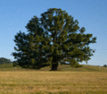
The White Oak Tree at CHO Airport


