Charlestown, Indiana facts for kids
Quick facts for kids
Charlestown, Indiana
|
|||
|---|---|---|---|
| City of Charlestown | |||
 |
|||
|
|||

Location of Charlestown in Clark County, Indiana.
|
|||
| Country | United States | ||
| State | Indiana | ||
| County | Clark | ||
| Township | Charlestown | ||
| Area | |||
| • Total | 11.49 sq mi (29.75 km2) | ||
| • Land | 11.45 sq mi (29.65 km2) | ||
| • Water | 0.04 sq mi (0.10 km2) | ||
| Elevation | 600 ft (200 m) | ||
| Population
(2020)
|
|||
| • Total | 7,775 | ||
| • Density | 679.16/sq mi (262.24/km2) | ||
| Time zone | UTC-5 (EST) | ||
| • Summer (DST) | UTC-4 (EDT) | ||
| ZIP code |
47111
|
||
| Area codes | 812 & 930 | ||
| FIPS code | 18-12124 | ||
| GNIS feature ID | 2393805 | ||
| Website | http://www.cityofcharlestown.com | ||
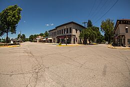
Charlestown is a city located within Charlestown Township, in Clark County, Indiana, United States. The population was 7,775 at the 2020 census.
Contents
History
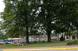
Charlestown was established in 1808, named after one of its surveyors, Charles Beggs, upon 300 acres (1.2 km2), of which 3 acres (12,000 m2) was designated for a town square. It was established one mile (1.6 km) northeast of Springville, and was responsible for Springville's demise.
Milling was important to the town, as the first mill was built in the area, on Fourteen Mile Creek, in 1804. This mill would be abandoned when John Work built a mill by use of a tunnel in 1814. Today, that mill is part of the Tunnel Mill Scout Reservation.
From 1811 to 1878 Charlestown was the county seat of Clark County, but as Jeffersonville had surpassed it economically, the county seat reverted to Jeffersonville in 1878.
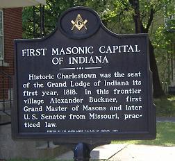
In 1818, the first Grand Lodge of Free & Accepted Masons in Indiana met in Charlestown, due to Jonathan Jennings' influence.
In 1940 the population of Charlestown was 900, but it swelled to 13,400 due to the building and operation of the Indiana Army Ammunition Plant (INAAP). This created a housing problem, as chicken, wood, and wash houses had to house all the new residents who flocked to the area for the jobs created by the INAAP. Additional problems caused by the rapid influx of new residents were improper sanitation at restaurants, inefficient sewers, gambling, panhandling, and diseases such as typhoid and malaria.
In 2014, the city announced they would be applying for a grant to redevelop Pleasant Ridge Subdivision, an impoverished area within the city. Some residents of the Pleasant Ridge Subdivision formed an association to fight against demolishing their homes via eminent domain. The City Council did not call for a vote on the issue and the grant issue failed. Starting in 2016, the city was accused of using excessive fines against homeowners in the subdivision in order to force them to sell to a private developer.
Geography
According to the 2010 census, Charlestown has a total area of 11.489 square miles (29.76 km2), of which 11.45 square miles (29.66 km2) (or 99.66%) is land and 0.039 square miles (0.10 km2) (or 0.34%) is water.
Demographics
| Historical population | |||
|---|---|---|---|
| Census | Pop. | %± | |
| 1850 | 250 | — | |
| 1870 | 2,204 | — | |
| 1880 | 1,103 | −50.0% | |
| 1890 | 888 | −19.5% | |
| 1900 | 915 | 3.0% | |
| 1910 | 864 | −5.6% | |
| 1920 | 820 | −5.1% | |
| 1930 | 859 | 4.8% | |
| 1940 | 939 | 9.3% | |
| 1950 | 4,785 | 409.6% | |
| 1960 | 5,726 | 19.7% | |
| 1970 | 5,933 | 3.6% | |
| 1980 | 5,596 | −5.7% | |
| 1990 | 5,889 | 5.2% | |
| 2000 | 5,993 | 1.8% | |
| 2010 | 7,585 | 26.6% | |
| 2020 | 7,775 | 2.5% | |
| U.S. Decennial Census | |||
2020 Census
As of the census of 2020, there were 7,775 people and 3,193 households residing in the city. The population density was 679.2 inhabitants per square mile (262.2/km2). There were 3,227 housing units at an average density of 281.8 per square mile (108.8/km2). The racial makeup of the city was 89.1% White, 1.8% African American, 1.0% Native American, 0.5% Asian, and 2.1% from two or more races. Hispanic or Latino of any race were 4.2% of the population.
2010 census
As of the census of 2010, there were 7,585 people, 2,884 households, and 2,034 families residing in the city. The population density was 662.4 inhabitants per square mile (255.8/km2). There were 3,169 housing units at an average density of 276.8 per square mile (106.9/km2). The racial makeup of the city was 89.9% White, 2.1% African American, 0.3% Native American, 0.3% Asian, 5.3% from other races, and 2.1% from two or more races. Hispanic or Latino of any race were 8.3% of the population.
There were 2,884 households, of which 39.7% had children under the age of 18 living with them, 46.7% were married couples living together, 17.9% had a female householder with no husband present, 5.9% had a male householder with no wife present, and 29.5% were non-families. 24.3% of all households were made up of individuals, and 9.4% had someone living alone who was 65 years of age or older. The average household size was 2.63 and the average family size was 3.09.
The median age in the city was 35.2 years. 28.4% of residents were under the age of 18; 8.8% were between the ages of 18 and 24; 27.5% were from 25 to 44; 24.2% were from 45 to 64; and 11.2% were 65 years of age or older. The gender makeup of the city was 47.5% male and 52.5% female.
Common Council
The Common Council of the City of Charlestown meets for its regular business meeting on the first Monday of the month, beginning at 6:30 p.m. in the council chambers of City Hall, located at 304 Main Cross Street, Charlestown, Indiana. The Council is the legislative body of the government of the City of Charlestown, responsible for drafting and approving ordinances and resolutions that affect all Charlestown residents.
Council members
- Councilperson At Large - Chuck Deaton
- District 1 Councilperson - Bo Bertram
- District 2 Councilperson - Ronald Blevins
- District 3 Councilperson - Shannon Elder
- District 4 Councilperson - Brian Hester
Education
Charlestown has numerous public schools, under the Greater Clark County Schools school district. Notable schools include: Pleasant Ridge Elementary School, Jonathan Jennings Elementary School, Charlestown Middle School, and Charlestown High School. Charlestown has a public library, a branch of the Charlestown-Clark County Public Library.
Notable people
- Michael Cleveland, award-winning bluegrass fiddle player
- Mary Garrett Hay, suffragist
- Steve Hamilton, former NBA and MLB player
- George Howk, Justice of the Indiana Supreme Court
- Jonathan Jennings, first Indiana state Governor
- Travis Meeks, front-man of Days of the New
- Nina Payne, an American dancer in 1920s Paris
- Zach Payne, member of the Indiana House of Representatives
- James Scott, Justice of the Indiana Supreme Court
- Jesse Vest, bass player, Days of the New, Tantric
- Days of the New, rock band
See also
 In Spanish: Charlestown (Indiana) para niños


