Chagres National Park facts for kids
Quick facts for kids Chagres National Park |
|
|---|---|
|
IUCN Category II (National Park)
|
|
 |
|

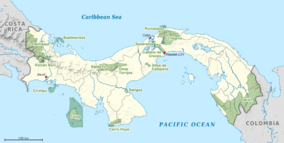
Chagres National Park (top center) within Panama
|
|
| Location | Panamá Province, Panama |
| Area | 129,000 hectares (320,000 acres) |
| Established | 1985 |
| Chagres National Park Foundation | |
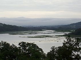
The Chagres National Park is a nature park and protected area created in 1986 located between the Province of Panama and Colon, in the Eastern sector of the Panama Canal with a total surface area of 129,000 hectares (320,000 acres).
The park contains tropical rain forests and a set of rivers which provide sufficient water to guarantee the operation of the Gatun Lake, main lake of the Panama Canal: the Chagres River and the Gatun River.
The highest point of the park is Cerro Jefe, at 1,007 m above sea level.
It is considered a Key Biodiversity Area of international significance.
Panama Canal Watershed
The park was created in 1985, with the aim of preserving the natural forest that composes it
- to produce water in amount and quality sufficient to guarantee the normal operation of the Panama Canal
- to supply potable water for the cities of Panama, Colon and la Chorrera,
- and the generation of electricity for the cities of Panama and Colon.
See also
 In Spanish: Parque nacional Chagres para niños

All content from Kiddle encyclopedia articles (including the article images and facts) can be freely used under Attribution-ShareAlike license, unless stated otherwise. Cite this article:
Chagres National Park Facts for Kids. Kiddle Encyclopedia.
