Cerro del Topo Chico facts for kids
Quick facts for kids Cerro del Topo Chico |
|
|---|---|

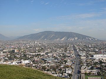
Cerro del Topo Chico seen from south
|
|
| Highest point | |
| Elevation | 1,178 m (3,865 ft) |
| Prominence | 618 m (2,028 ft) |
| Naming | |
| English translation | Little molehill |
| Language of name | Spanish |
| Geography | |
|
Lua error in Module:Location_map at line 420: attempt to index field 'wikibase' (a nil value).
|
|
| Location | Escobedo, San Nicolás, Monterrey; Nuevo León |
| Country | |
| Parent range | Sierra Madre Oriental |
| Geology | |
| Mountain type | Mountain |
The Cerro del Topo Chico (Spanish, 'Small Mole Hill', from the Latin talpa 'mole') is a mountain and a protected area in the Escobedo, San Nicolás and Monterrey municipalities; state of Nuevo León, Mexico. The summit reaches 1,178 meters above sea level, and it has 618 meters of prominence (Parent: Cerro de las Mitras). The mountain is about 7.5 km long, is a symbol of Escobedo and San Nicolás, and is completely surrounded by Monterrey metropolitan area. It is known for being the source of the Topo Chico mineral water.
See also
 In Spanish: Cerro del Topo Chico para niños

All content from Kiddle encyclopedia articles (including the article images and facts) can be freely used under Attribution-ShareAlike license, unless stated otherwise. Cite this article:
Cerro del Topo Chico Facts for Kids. Kiddle Encyclopedia.
