Cerro Solo facts for kids
Quick facts for kids Cerro Solo |
|
|---|---|

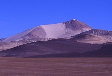
Cerro Solo from the North
|
|
| Highest point | |
| Elevation | 6,215 m (20,390 ft) |
| Prominence | 715 m (2,346 ft) |
| Parent peak | Nevado Tres Cruces |
| Geography | |
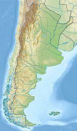
| Location | Argentina-Chile |
| Parent range | Andes |
| Geology | |
| Mountain type | Stratovolcano |
| Last eruption | Unknown |
| Climbing | |
| First ascent | 02/21/1950 - Luis Alvarado, Jorge Balastino, Carlos and Oscar Alvarez (Chile) |
| Easiest route | Hike |
Cerro Solo is a large stratovolcano on the border between Argentina and Chile, west of Ojos del Salado with an elevation of 6,215 metres (20,390 ft) metres. It consists of nine eruptive centers and is covered in light-colored rhyodacite pyroclastic flow deposits.
Its territory is within the Argentinean protection area of Catamarca High Andean and Puna Lakes Ramsar Site. It is located in the territory of the Argentinean province of Catamarca (commune of Fiambalá) and the Chilean province of Copiapo (commune of Copiapó).
First Ascent
Solo was first climbed by Luis Alvarado, Jorge Balastino, Carlos and Oscar Alvarez (Chile) on 21 February 1950.
See also
 In Spanish: Cerro Solo para niños
- List of volcanoes in Argentina
- List of volcanoes in Chile

All content from Kiddle encyclopedia articles (including the article images and facts) can be freely used under Attribution-ShareAlike license, unless stated otherwise. Cite this article:
Cerro Solo Facts for Kids. Kiddle Encyclopedia.

