Cataract Falls (Indiana) facts for kids
Quick facts for kids Cataract Falls |
|
|---|---|

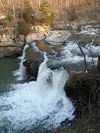
View from side railing
|
|
| Lua error in Module:Infobox_mapframe at line 185: attempt to index field 'wikibase' (a nil value). | |
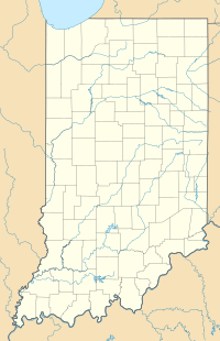
| Location | Owen County, Indiana |
| Coordinates | 39°26′04″N 86°48′48″W / 39.43444°N 86.81333°W |
| Total height | 45 feet (14 m) Upper Falls 30 feet (9.1 m) Lower Falls |
| Watercourse | Mill Creek |
Cataract Falls is a waterfall located in northern Owen County in the west central part of the U.S. state of Indiana. The largest waterfall by volume in the state, it is part of the Lieber State Recreation Area.
Cataract Falls consists of two sets of waterfalls on Mill Creek separated by about 1 mile (1.6 km). Both falls consist of a series of drops. The total height of the Upper Falls is approximately 45 feet (14 m), while that of the Lower Falls is about 30 feet (9.1 m).
Immediately downstream of the Lower Falls, Mill Creek enters the southern end of Cagles Mill Lake, near the towns of Cunot and Cataract. The falls are just off State Road 42 and close to State Road 243.

All content from Kiddle encyclopedia articles (including the article images and facts) can be freely used under Attribution-ShareAlike license, unless stated otherwise. Cite this article:
Cataract Falls (Indiana) Facts for Kids. Kiddle Encyclopedia.

