Careywood, Idaho facts for kids
Quick facts for kids
Careywood, Idaho
|
|
|---|---|
| Country | United States |
| State | Idaho |
| County | Bonner |
| Elevation | 2,280 ft (690 m) |
| Time zone | UTC-8 (Pacific (PST)) |
| • Summer (DST) | UTC-7 (PDT) |
| ZIP code |
83809
|
| Area code(s) | 208, 986 |
| GNIS feature ID | 396235 |
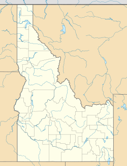
Careywood is an unincorporated community in Bonner County, Idaho, United States. Careywood is located on U.S. Route 95 6.5 miles (10.5 km) north-northeast of Athol. Careywood had a post office with ZIP code 83809 which closed in 2015.
History
Originally known as Severance, the town was renamed Careywood after a man named Carey from Spokane who bought land in the area. At the time, Careywood was involved in the logging industry. Caryewood's population was 25 in 1960.
Climate
This region experiences warm (but not hot) and dry summers, with no average monthly temperatures above 71.6 °F. According to the Köppen Climate Classification system, Careywood has a warm-summer Mediterranean climate, abbreviated "Csb" on climate maps.

All content from Kiddle encyclopedia articles (including the article images and facts) can be freely used under Attribution-ShareAlike license, unless stated otherwise. Cite this article:
Careywood, Idaho Facts for Kids. Kiddle Encyclopedia.


