Capes on the Mississippi River facts for kids
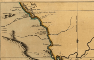
The term cape has a different tradition of usage in the American Midwest along the Mississippi River. The middle Mississippi River Valley once formed part of the French Colonies of Quebec and Louisiana, also referred to as Upper Louisiana (Haute-Louisiane) or the Illinois Country (Pays des Illinois). The Illinois Country also included the left bank of the Mississippi River in present-day Missouri.
The French explorers and mapmakers used the word cape (or in French, "cap") to describe the bluffs and promontories along the Mississippi River. A "cap" could sit next to any body of water, not just the ocean. Spanish authorities also used the term cabo (cape) for points on the Mississippi River. Along the Mississippi River between St. Louis and Cairo there are a number of capes of French origin.
| Capes on the Mississippi River and tributaries | |||||
|---|---|---|---|---|---|
| Name | Original French Name | Translation | State | Location | |
| Cape Cinque Hommes or
Cape St. Cosme |
Cap des Cinque Hommes or
Cap St. Cosme |
cape of five men or
cape of St. Cosme |
MO | 37°41′33.2″N 89°31′45.3″W / 37.692556°N 89.529250°W | |
| Cape Creche | Cap Crèche | cape manger | MO | ||
| Cape La Croix | Cap de la Croix | cape of the cross | MO | 37°14′53.51″N 89°28′05.76″W / 37.2481972°N 89.4682667°W | |
| Cap à la Cruche | Cap à la Cruche | cape pitcher | MO | ||
| Cape Fair | -- | -- | MO | 36°43′48″N 93°30′37″W / 36.73000°N 93.51028°W | |
| Cape Garlick | Cap à l'Ail | cape garlic | MO | ||
| Cape Girardeau | Cap de Girardot | cape of Girardot | MO | 37°18′21″N 89°31′05″W / 37.30583°N 89.51806°W | |
| Cap au Gris | Cap au Gris | cape of gray | MO | 38°59′56″N 90°41′30″W / 38.99889°N 90.69167°W | |
| Cape de la Grotte | Cap de la Grotte | cape of the caves | MO | ||
| Cap aux Pistolets | Cap aux Pistolets | cape of the pistols | MN | ||
| Cape La Roche | Cap de la Roche | cape of the rock | MO | ||
| Cape de Roche Blanche | Cap de Roche blanche | cape of the white rock | MO | ||
| Cape Rock | -- | -- | MO | 37°19′43″N 89°29′45″W / 37.32861°N 89.49583°W | |
| Cape St. Anthony | Cap de St. Antoine | cape of Saint Anthony | IL | 37°37′57″N 89°30′7″W / 37.63250°N 89.50194°W | |
| Cape Swallow | Cap l'hirondelle | cape swallow | MO | ||
| Pointed Cape | Cap de la Pointe | cape of the point | MO | ||


