Cape Chidley Islands facts for kids

Cape Chidley Islands area
|
|
| Geography | |
|---|---|
| Location | Labrador Sea |
| Coordinates | 60°25′45″N 64°27′50″W / 60.42917°N 64.46389°W |
| Archipelago | Canadian Arctic Archipelago |
| Area | 10 km2 (3.9 sq mi) |
| Highest point | 401 m (1,316 ft) |
| Administration | |
| Nunavut | Nunavut |
| Region | Qikiqtaaluk |
| Demographics | |
| Population | Uninhabited |
| Source: Cape Chidley Islands at the Atlas of Canada | |
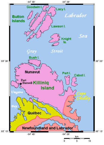
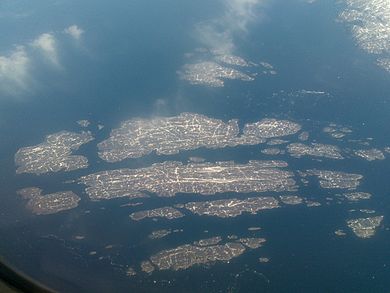
The Cape Chidley Islands are members of the Canadian Arctic Archipelago in the territory of Nunavut. They are located in the Labrador Sea at the south end of the entrance to the Hudson Strait, north of Killiniq Island's Cape Chidley, and separated from Killiniq Island by the MacGregor Strait.
Cabot Island is the eastern of the two islands and is 2 mi (3.2 km) long. It has two summits, the northern one being 401 m (1,316 ft) above sea level, and the southern one being 325 m (1,066 ft) high.
Pert Island is the smaller of the two islands and is located 0.5 mi (0.80 km) mile to the west. Its highest point is 385 m (1,263 ft) above sea level. Port Burwell lies 20 km (12 mi) west of Pert Island.

All content from Kiddle encyclopedia articles (including the article images and facts) can be freely used under Attribution-ShareAlike license, unless stated otherwise. Cite this article:
Cape Chidley Islands Facts for Kids. Kiddle Encyclopedia.


