Camp Wood, Texas facts for kids
Quick facts for kids
Camp Wood, Texas
|
|
|---|---|

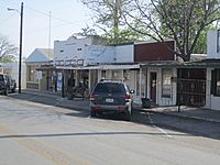
A glimpse of along Nueces Street (Texas State Highway 55) in Camp Wood, March 2011
|
|

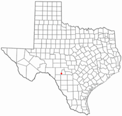
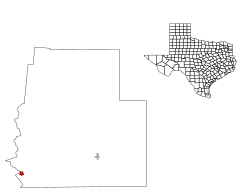
Location of Camp Wood, Texas
|
|
 |
|
| Country | United States |
| State | Texas |
| County | Real |
| Area | |
| • Total | 0.50 sq mi (1.30 km2) |
| • Land | 0.50 sq mi (1.30 km2) |
| • Water | 0.00 sq mi (0.00 km2) |
| Elevation | 1,463 ft (446 m) |
| Population
(2020)
|
|
| • Total | 517 |
| • Estimate
(2019)
|
731 |
| • Density | 1,450.40/sq mi (560.52/km2) |
| Time zone | UTC-6 (Central (CST)) |
| • Summer (DST) | UTC-5 (CDT) |
| ZIP code |
78833
|
| Area code | 830 |
| FIPS code | 48-12388 |
| GNIS feature ID | 2409970 |
Camp Wood is a city in Real County, Texas, United States, in the Texas Hill Country, which is part of the Edwards Plateau. The population was 517 at the 2020 census.
History
The town was established in 1920.
Geography
According to the United States Census Bureau, the city has a total area of 0.5 square miles (1.3 km2), all land.
Climate
The climate in this area is characterized by hot, humid summers and generally mild to cool winters. Camp Wood has a humid subtropical climate, Cfa on climate maps according to the Köppen climate classification system.
Demographics
2020 census
| Race | Number | Percentage |
|---|---|---|
| White (NH) | 292 | 56.48% |
| Black or African American (NH) | 1 | 0.19% |
| Asian (NH) | 2 | 0.39% |
| Pacific Islander (NH) | 1 | 0.19% |
| Mixed/Multi-Racial (NH) | 19 | 3.68% |
| Hispanic or Latino | 202 | 39.07% |
| Total | 517 |
As of the 2020 United States census, there were 517 people, 262 households, and 179 families residing in the city.
Education
The City of Camp Wood is served by the Nueces Canyon Consolidated Independent School District.
See also
 In Spanish: Camp Wood para niños

