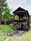
California Historical Landmarks in El Dorado County facts for kids
This list includes properties and districts listed on the California Historical Landmark listing in El Dorado County, California. Click the "Map of all coordinates" link to the right to view a Google map of all properties and districts with latitude and longitude coordinates in the table below.
| Image | Landmark name | Location | City or town | Summary | |
|---|---|---|---|---|---|
| 748 | Coloma Road-Coloma | Marshall Gold Discovery State Historic Park 38°48′08″N 120°53′34″W / 38.802317°N 120.892767°W |
Coloma | ||
| 747 | Coloma Road-Rescue | 4222 Green Valley Rd at Rescue Junction General Store 38°42′40″N 120°57′07″W / 38.711167°N 120.952°W |
Rescue | ||
| 572 | Condemned Bar | Folsom Lake State Recreation Area |
Folsom | ||
| 487 | Diamond Springs | Hwy 49 and China Garden Rd. 38°41′41″N 120°48′54″W / 38.694722°N 120.815°W |
Diamond Springs | ||
| 486 | El Dorado | Pleasant Valley Rd & Church St. 38°40′58″N 120°50′52″W / 38.682778°N 120.847778°W |
El Dorado | ||
| 700 | El Dorado-Nevada House (Mud Springs) - Overland Pony Express Route in California | Pleasant Valley Rd. near Church St. |
El Dorado | ||
| 728 | Friday's Station - Overland Pony Express Route in California | Stateline, Hwy 50 38°57′51″N 119°56′21″W / 38.964067°N 119.93905°W |
Friday's Station | ||
| 484 | Georgetown | Georgetown Fire Station 38°54′24″N 120°50′20″W / 38.906617°N 120.838933°W |
Georgetown | ||
| 530 | Gold discovery site | Marshall Gold Discovery State Historic Park 38°48′00″N 120°53′48″W / 38.8°N 120.896667°W |
Coloma | ||
| 521 | Greenwood | State Hwy 193 and Greenwood St. 38°53′48″N 120°54′46″W / 38.896667°N 120.912778°W |
Greenwood | ||
| 141 | Hangman's Tree | 305 Main St. 38°43′42″N 120°48′09″W / 38.728283°N 120.80245°W |
Placerville | ||
| 319 | Marshall's Blacksmith Shop | State Hwy 193 |
Kelsey | On private property | |
| 143 | Marshall Monument | Marshall Gold Discovery State Historic Park 38°47′48″N 120°53′40″W / 38.796567°N 120.894583°W |
Coloma | ||
| 767 | Methodist Episcopal Church | 1031 Thompson Way 38°43′40″N 120°47′40″W / 38.7278°N 120.79445°W |
Placerville | ||
| 705 | Moore's (Riverton) - Overland Pony Express Route in California | U.S. Hwy 50 and Ice House Rd. 38°46′16″N 120°26′57″W / 38.771183°N 120.449133°W |
Kyburz | ||
| 569 | Mormon Island | Folsom Lake State Recreation Area 38°42′13″N 121°07′03″W / 38.7035°N 121.1174°W |
Folsom | ||
| 699 | Mormon Tavern - Overland Pony Express Route in California | 38°39′22″N 121°03′35″W / 38.6561°N 121.05975°W |
El Dorado Hills | ||
| 1051 | Mountain Quarries Railroad Bridge | 38°54′46″N 121°02′25″W / 38.9128°N 121.0403°W |
Auburn, California | ||
| 570 | Negro Hill | Folsom Lake State Recreation Area |
Folsom | ||
| 475 | Old Dry Higgins-Old Hangtown | Bedford and Main St. 38°43′47″N 120°47′57″W / 38.729717°N 120.799083°W |
Placerville | ||
| 701 | Placerville - Overland Pony Express Route in California | Main St. & Sacramento St. 38°43′40″N 120°48′12″W / 38.727883°N 120.803283°W |
Placerville | ||
| 703 | Pleasant Grove House - Overland Pony Express Route in California | Green Valley Rd. 38°41′53″N 121°01′14″W / 38.697917°N 121.020667°W |
Rescue | ||
| 571 | Salmon Falls | Folsom Lake State Recreation Area 38°45′29″N 121°03′30″W / 38.758056°N 121.058333°W |
Folsom | ||
| 456 | Shingle Springs | Historic district 38°39′57″N 120°55′34″W / 38.665833°N 120.926111°W |
Shingle Springs | ||
| 551 | Site of California's First Grange Hall | State Hwy 49 38°50′38″N 121°00′54″W / 38.843922°N 121.014983°W |
Pilot Hill | ||
| 704 | Sportsman's Hall - Overland Pony Express Route in California | 5622 Old Pony Express Trail 38°45′00″N 120°36′41″W / 38.7501°N 120.61125°W |
Cedar Grove | ||
| 707 | Strawberry Valley House - Overland Pony Express Route in California | Hwy 50 38°47′44″N 120°08′54″W / 38.795417°N 120.148333°W |
Strawberry | ||
| 142 | Studebaker's Shop | 543 Main St. 38°43′46″N 120°47′51″W / 38.729417°N 120.7975°W |
Placerville | ||
| 815 | Wakamatsu Tea and Silk Farm Colony | Gold Trails Elementary School, 889 Cold Springs Rd. |
Gold Hill | ||
| 708 | Yank's Station - Overland Pony Express Route in California | Yank's Station shopping center 38°51′22″N 120°00′47″W / 38.856111°N 120.013056°W |
Meyers | ||
| 1048 | Site of Echo Summit | Just off of Hwy 50, in the entrance to the parking lot for Adventure Mountain recreation area. 38°48′51″N 120°02′03″W / 38.814295°N 120.034209°W |
Echo Summit |

All content from Kiddle encyclopedia articles (including the article images and facts) can be freely used under Attribution-ShareAlike license, unless stated otherwise. Cite this article:
California Historical Landmarks in El Dorado County Facts for Kids. Kiddle Encyclopedia.


