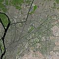
Cairo facts for kids
Quick facts for kids
Cairo
القاهرة
|
||
|---|---|---|
|
Clockwise from top:
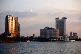
View of the Nile, Muizz Street, Baron Empain Palace, Cairo Citadel, Talaat Harb Square, Ibn Tulun Mosque |
||
|
||
| Nickname(s):
The City of a Thousand Minarets
|
||
| Country | ||
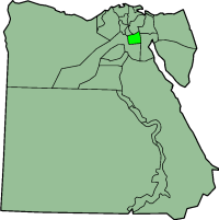
| Governorate | Cairo | |
| Founded | 969 CE | |
| Founded by | Fatimid dynasty | |
| Area | ||
| • Metropolis | 214 km2 (83 sq mi) | |
| • Metro | 17,267.6 km2 (6,667.1 sq mi) | |
| Elevation | 23 m (75 ft) | |
| Population
(2017)
|
||
| • Metropolis | 19,500,000 | |
| • Density | 19,376/km2 (50,180/sq mi) | |
| • Urban | 18,290,000 | |
| • Metro | 20,439,541 | |
| • Demonym | Cairene | |
| Time zone | UTC+2 (EET) | |
| Area code(s) | (+20) 2 | |
| Website | www.cairo.gov.eg | |
| Official name: Historic Cairo | ||
| Type: | Cultural | |
| Criteria: | i, iii, vi | |
| Designated: | 1979 | |
| State Party: | Egypt | |
| Region: | Arab States | |
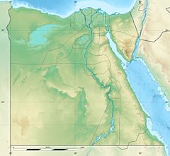
Cairo (Arabic: القاهرة, usually transliterated as Al-Qāhirah) is the capital and largest city in Egypt. The city name can be translated as the one who won. Cairo is sometimes called "Mother of the World" (Um al Dunya).
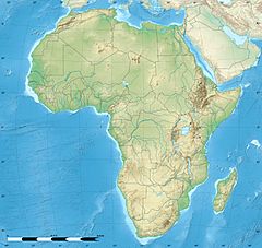
Cairo has 7,947,121 people. About 17,290,000 people live in its urban area. This makes it the biggest city of the Arab World. It also is the city with the biggest urban area in Africa
The city is on the Nile River.
Contents
History
The area around the city was an important focal point of Ancient Egypt.
In 968, the Fatimids entered Egypt and they made Cairo the capital of their caliphate.
The Al Azhar mosque and university was made in 972. This became the world's oldest university. It is the most widely known seminary in the Islamic world.
In 1992, Cairo was devastated by a 5.8 magnitude earthquake that caused 545 deaths, injuring 6,512, and made 50,000 people homeless, the most destructive since 1847.
Etymology
The name of Cairo is derived from the Arabic al-Qāhirah (القاهرة), meaning 'the Vanquisher' or 'the Conqueror', given by the Fatimid Caliph al-Mu'izz following the establishment of the city as the capital of the Fatimid dynasty. Its full, formal name was al-Qāhirah al-Mu'izziyyah (القاهرة المعزيّة), meaning 'the Vanquisher of al-Mu'izz'. It is also supposedly due to the fact that the planet Mars, known in Arabic by names such as an-Najm al-Qāhir (النجم القاهر, 'the Conquering Star'), was rising at the time of the city's founding.
Egyptians often refer to Cairo as Maṣr ( مَصر), the Egyptian Arabic name for Egypt itself, emphasizing the city's importance for the country.
There are a number of Coptic names for the city. Tikešrōmi (Coptic: Ϯⲕⲉϣⲣⲱⲙⲓ Late Coptic:) is attested in the 1211 text The Martyrdom of John of Phanijoit and is either a calque meaning 'man breaker' (Ϯ-, 'the', ⲕⲁϣ-, 'to break', and ⲣⲱⲙⲓ, 'man'), akin to Arabic al-Qāhirah, or a derivation from Arabic قَصْر الرُوم (qaṣr ar-rūm, "the Roman castle"), another name of Babylon Fortress in Old Cairo. The Arabic name is also calqued as ⲧⲡⲟⲗⲓⲥ ϯⲣⲉϥϭⲣⲟ, "the victor city" in the Coptic antiphonary.
The form Khairon (Coptic: ⲭⲁⲓⲣⲟⲛ) is attested in the modern Coptic text Ⲡⲓⲫⲓⲣⲓ ⲛ̀ⲧⲉ ϯⲁⲅⲓⲁ ⲙ̀ⲙⲏⲓ Ⲃⲉⲣⲏⲛⲁ (The Tale of Saint Verina). Lioui (Ⲗⲓⲟⲩⲓ Late Coptic:) or Elioui (Ⲉⲗⲓⲟⲩⲓ Late Coptic:) is another name which is descended from the Greek name of Heliopolis (Ήλιούπολις). Some argue that Mistram (Ⲙⲓⲥⲧⲣⲁⲙ Late Coptic:) or Nistram (Ⲛⲓⲥⲧⲣⲁⲙ Late Coptic:) is another Coptic name for Cairo, although others think that it is rather a name for the Abbasid province capital al-Askar. Ⲕⲁϩⲓⲣⲏ (Kahi•ree) is a popular modern rendering of an Arabic name (others being Ⲕⲁⲓⲣⲟⲛ [Kairon] and Ⲕⲁϩⲓⲣⲁ [Kahira]) which is modern folk etymology meaning 'land of sun'. Some argue that it was a name of an Egyptian settlement upon which Cairo was built, but it is rather doubtful as this name is not attested in any Hieroglyphic or Demotic source, although some researchers, like Paul Casanova, view it as a legitimate theory. Cairo is also referred to as Ⲭⲏⲙⲓ (Late Coptic:) or Ⲅⲩⲡⲧⲟⲥ (Late Coptic:), which means Egypt in Coptic, the same way it is referred to in Egyptian Arabic.
Sometimes the city is informally referred to as Cairo by people from Alexandria ( Egyptian Arabic: كايرو).
Transport
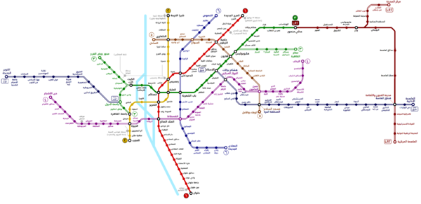
Cairo has an extensive road network, rail system, subway system and maritime services. Road transport is facilitated by personal vehicles, taxi cabs, privately owned public buses and microbuses. Cairo International Airport is the country's largest airport and one of the busiest airports in Africa.
Public transportation
The Cairo Transportation Authority (CTA) manages Cairo's public transit. The subway system, the Cairo Metro, is a fast and efficient way of getting around Cairo. The metro network covers Helwan and other suburbs. It can get very crowded during rush hour. Two train cars (the fourth and fifth ones) are reserved for women only, although women may ride in any car they want.
Trams in Greater Cairo and Cairo trolleybus were used as modes of transportation, but were closed in the 1970s everywhere except Heliopolis and Helwan. These were shut down in 2014, after the Egyptian Revolution.
In 2017, plans to construct two monorail systems were announced, one linking 6th of October to suburban Giza, a distance of 35 km (22 mi), and the other linking Nasr City to New Cairo, a distance of 52 km (32 mi).
Roads
Two trans-African automobile routes originate in Cairo: the Cairo-Cape Town Highway and the Cairo-Dakar Highway. An extensive road network connects Cairo with other Egyptian cities and villages. There is a new Ring Road that surrounds the outskirts of the city, with exits that reach outer Cairo districts. There are flyovers and bridges, such as the 6th October Bridge that, when the traffic is not heavy, allow fast means of transportation from one side of the city to the other.
Cairo traffic is known to be overwhelming and overcrowded. Traffic moves at a relatively fluid pace. Drivers tend to be aggressive, but are more courteous at junctions, taking turns going, with police aiding in traffic control of some congested areas.
Other forms of transport
- Cairo Taxi/Yellow Cab
- Cairo Nile Ferry
- Careem
- Uber
- DiDi
Climate
The city of Cairo has a hot desert climate (BWh), meaning it has a hot, sunny and dry climate a year long. The city, however, has more humidity than other cities with the hot desert climate (BWh).
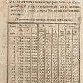
| Climate data for Cairo | |||||||||||||
|---|---|---|---|---|---|---|---|---|---|---|---|---|---|
| Month | Jan | Feb | Mar | Apr | May | Jun | Jul | Aug | Sep | Oct | Nov | Dec | Year |
| Record high °F (°C) | 88.0 (31.1) |
93.6 (34.2) |
100.2 (37.9) |
109.8 (43.2) |
118.0 (47.8) |
115.5 (46.4) |
108.7 (42.6) |
110.1 (43.4) |
110.7 (43.7) |
106.0 (41.1) |
99.3 (37.4) |
86.4 (30.2) |
118.0 (47.8) |
| Mean daily maximum °F (°C) | 66.0 (18.9) |
68.7 (20.4) |
74.3 (23.5) |
82.9 (28.3) |
90.0 (32.2) |
93.0 (33.9) |
94.5 (34.7) |
93.6 (34.2) |
90.7 (32.6) |
84.6 (29.2) |
76.6 (24.8) |
68.5 (20.3) |
82.0 (27.8) |
| Daily mean °F (°C) | 56.5 (13.6) |
58.8 (14.9) |
62.4 (16.9) |
70.2 (21.2) |
76.1 (24.5) |
81.1 (27.3) |
81.7 (27.6) |
81.3 (27.4) |
79.0 (26.1) |
73.9 (23.3) |
66.0 (18.9) |
59.0 (15.0) |
70.5 (21.4) |
| Mean daily minimum °F (°C) | 48.0 (8.9) |
49.5 (9.7) |
52.9 (11.6) |
58.3 (14.6) |
63.9 (17.7) |
68.2 (20.1) |
72.0 (22.2) |
71.8 (22.1) |
68.9 (20.5) |
63.3 (17.4) |
57.4 (14.1) |
50.7 (10.4) |
60.4 (15.8) |
| Record low °F (°C) | 34.2 (1.2) |
38.5 (3.6) |
41.0 (5.0) |
45.7 (7.6) |
54.1 (12.3) |
61.0 (16.1) |
64.8 (18.2) |
66.0 (18.9) |
58.1 (14.5) |
54.1 (12.3) |
41.4 (5.2) |
37.0 (2.8) |
34.2 (1.2) |
| Average precipitation inches (mm) | 0.20 (5.1) |
0.15 (3.8) |
0.15 (3.8) |
0.04 (1.0) |
0.02 (0.51) |
0.00 (0.00) |
0.00 (0.00) |
0.00 (0.00) |
0.00 (0.00) |
0.03 (0.76) |
0.15 (3.8) |
0.23 (5.8) |
0.97 (24.57) |
| Source: World Meteorological Organization (UN) (1971–2000), | |||||||||||||
Tourism
The great pyramids of Giza and the step pyramid of Sakkara are just outside of the city.
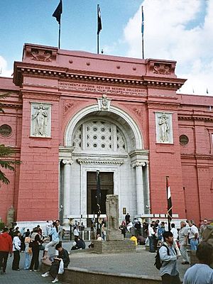
The Egyptian Museum holds the world’s largest collection of antiquities from the time of the ancient Pharaohs. Many treasures from the tomb of King Tutankhamun are in this museum.
Food
The majority of Cairenes make food for themselves and make use of local produce markets. The restaurant scene includes Arab cuisine and Middle Eastern cuisine, including local staples such as koshary. The city's most exclusive restaurants are typically concentrated in Zamalek and around the luxury hotels lining the shore of the Nile near the Garden City district. Influence from modern western society is also evident, with American chains such as McDonald's, Arby's, Pizza Hut, Subway, and Kentucky Fried Chicken being easy to find in central areas.
Cityscape and landmarks
Tahrir Square
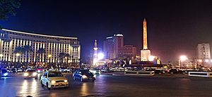
Tahrir Square was founded during the mid 19th century with the establishment of modern downtown Cairo. It was first named Ismailia Square, after the 19th-century ruler Khedive Ismail, who commissioned the new downtown district's 'Paris on the Nile' design. After the Egyptian Revolution of 1919 the square became widely known as Tahrir (Liberation) Square, though it was not officially renamed as such until after the 1952 Revolution which eliminated the monarchy. Several notable buildings surround the square including, the American University in Cairo's downtown campus, the Mogamma governmental administrative Building, the headquarters of the Arab League, the Nile Ritz Carlton Hotel, and the Egyptian Museum. Being at the heart of Cairo, the square witnessed several major protests over the years. However, the most notable event in the square was being the focal point of the 2011 Egyptian Revolution against former president Hosni Mubarak. In 2020 the government completed the erection of a new monument in the center of the square featuring an ancient obelisk from the reign of Ramses II, originally unearthed at Tanis (San al-Hagar) in 2019, and four ram-headed sphinx statues moved from Karnak.
Egyptian Museum
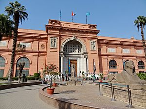
The Museum of Egyptian Antiquities, known commonly as the Egyptian Museum, is home to the most extensive collection of ancient Egyptian antiquities in the world. It has 136,000 items on display, with many more hundreds of thousands in its basement storerooms. Among the collections on display are the finds from the tomb of Tutankhamun.
Grand Egyptian Museum
Much of the collection of the Museum of Egyptian Antiquities, including the Tutankhamun collection, are slated to be moved to the new Grand Egyptian Museum, under construction in Giza and was due to open by the end of 2020.
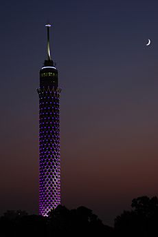
Cairo Tower
The Cairo Tower is a free-standing tower with a revolving restaurant at the top. It provides a bird's eye view of Cairo to the restaurant patrons. It stands in the Zamalek district on Gezira Island in the Nile River, in the city centre. At 187 metres (614 feet), it is 44 metres (144 feet) higher than the Great Pyramid of Giza, which stands some 15 kilometres (9 miles) to the southwest.
Old Cairo
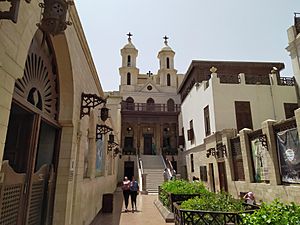
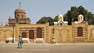
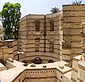
This area of Cairo is so-named as it contains the remains of the ancient Roman fortress of Babylon and also overlaps the original site of Fustat, the first Arab settlement in Egypt (7th century AD) and the predecessor of later Cairo. The area includes Coptic Cairo, which holds a high concentration of old Christian churches such as the Hanging Church, the Greek Orthodox Church of St. George, and other Christian or Coptic buildings, most of which are located in an enclave on the site of the ancient Roman fortress. It is also the location of the Coptic Museum, which showcases the history of Coptic art from Greco-Roman to Islamic times, and of the Ben Ezra Synagogue, the oldest and best-known synagogue in Cairo, where the important collection of Geniza documents were discovered in the 19th century.
To the north of this Coptic enclave is the Amr ibn al-'As Mosque, the first mosque in Egypt and the most important religious centre of what was formerly Fustat, founded in 642 AD right after the Arab conquest but rebuilt many times since. A part of the former city of Fustat has also been excavated to the east of the mosque and of the Coptic enclave, although the archeological site is threatened by encroaching construction and modern development. To the northwest of Babylon Fortress and the mosque is the Monastery of Saint Mercurius (or Dayr Abu Sayfayn), an important and historic Coptic religious complex consisting of the Church of Saint Mercurius, the Church of Saint Shenute, and the Church of the Virgin (also known as al-Damshiriya). Several other historic churches are also situated to the south of Babylon Fortress.
Islamic Cairo
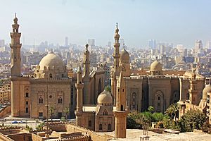
Cairo holds one of the greatest concentrations of historical monuments of Islamic architecture in the world. The areas around the old walled city and around the Citadel are characterized by hundreds of mosques, tombs, madrasas, mansions, caravanserais, and fortifications dating from the Islamic era and are often referred to as "Islamic Cairo", especially in English travel literature. It is also the location of several important religious shrines such as the al-Hussein Mosque (whose shrine is believed to hold the head of Husayn ibn Ali), the Mausoleum of Imam al-Shafi'i (founder of the Shafi'i madhhab, one of the primary schools of thought in Sunni Islamic jurisprudence), the Tomb of Sayyida Ruqayya, the Mosque of Sayyida Nafisa, and others.
The first mosque in Egypt was the Mosque of Amr ibn al-As in what was formerly Fustat, the first Arab-Muslim settlement in the area. However, the Mosque of Ibn Tulun is the oldest mosque that still retains its original form and is a rare example of Abbasid architecture from the classical period of Islamic civilization. It was built in 876–879 AD in a style inspired by the Abbasid capital of Samarra in Iraq. It is one of the largest mosques in Cairo and is often cited as one of the most beautiful. Another Abbasid construction, the Nilometer on Roda Island, is the oldest original structure in Cairo, built in 862 AD. It was designed to measure the level of the Nile, which was important for agricultural and administrative purposes.
The settlement that was formally named Cairo (Arabic: al-Qahira) was founded to the northeast of Fustat in 959 AD by the victorious Fatimid army. The Fatimids built it as a separate palatial city which contained their palaces and institutions of government. It was enclosed by a circuit of walls, which were rebuilt in stone in the late 11th century AD by the vizier Badr al-Gamali, parts of which survive today at Bab Zuwayla in the south and Bab al-Futuh and Bab al-Nasr in the north. Among the extant monuments from the Fatimid era are the large Mosque of al-Hakim, the Aqmar Mosque, Juyushi Mosque, Lulua Mosque, and the Mosque of Al-Salih Tala'i.
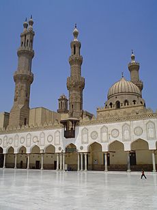
One of the most important and lasting institutions founded in the Fatimid period was the Mosque of al-Azhar, founded in 970 AD, which competes with the Qarawiyyin in Fes for the title of oldest university in the world. Today, al-Azhar University is the foremost Center of Islamic learning in the world and one of Egypt's largest universities with campuses across the country. The mosque itself retains significant Fatimid elements but has been added to and expanded in subsequent centuries, notably by the Mamluk sultans Qaytbay and al-Ghuri and by Abd al-Rahman Katkhuda in the 18th century.
The most prominent architectural heritage of medieval Cairo, however, dates from the Mamluk period, from 1250 to 1517 AD. The Mamluk sultans and elites were eager patrons of religious and scholarly life, commonly building religious or funerary complexes whose functions could include a mosque, madrasa, khanqah (for Sufis), a sabil (water dispensary), and a mausoleum for themselves and their families. Among the best-known examples of Mamluk monuments in Cairo are the huge Mosque-Madrasa of Sultan Hasan, the Mosque of Amir al-Maridani, the Mosque of Sultan al-Mu'ayyad (whose twin minarets were built above the gate of Bab Zuwayla), the Sultan Al-Ghuri complex, the funerary complex of Sultan Qaytbay in the Northern Cemetery, and the trio of monuments in the Bayn al-Qasrayn area comprising the complex of Sultan al-Mansur Qalawun, the Madrasa of al-Nasir Muhammad, and the Madrasa of Sultan Barquq. Some mosques include spolia (often columns or capitals) from earlier buildings built by the Romans, Byzantines, or Copts.
The Mamluks, and the later Ottomans, also built wikalas or caravanserais to house merchants and goods due to the important role of trade and commerce in Cairo's economy. Still intact today is the Wikala al-Ghuri, which today hosts regular performances by the Al-Tannoura Egyptian Heritage Dance Troupe. The Khan al-Khalili is a commercial hub which also integrated caravanserais (also known as khans).
Citadel of Cairo
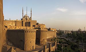
The Citadel is a fortified enclosure begun by Salah al-Din in 1176 AD on an outcrop of the Muqattam Hills as part of a large defensive system to protect both Cairo to the north and Fustat to the southwest. It was the centre of Egyptian government and residence of its rulers until 1874, when Khedive Isma'il moved to 'Abdin Palace. It is still occupied by the military today, but is now open as a tourist attraction comprising, notably, the National Military Museum, the 14th century Mosque of al-Nasir Muhammad, and the 19th century Mosque of Muhammad Ali which commands a dominant position on Cairo's skyline.
Khan el-Khalili
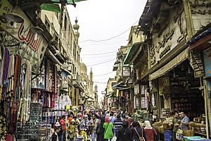
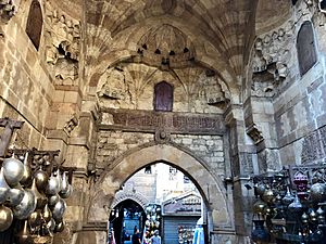
Khan el-Khalili is an ancient bazaar, or marketplace adjacent to the Al-Hussein Mosque. It dates back to 1385, when Amir Jarkas el-Khalili built a large caravanserai, or khan. (A caravanserai is a hotel for traders, and usually the focal point for any surrounding area.) This original caravanserai building was demolished by Sultan al-Ghuri, who rebuilt it as a new commercial complex in the early 16th century, forming the basis for the network of souqs existing today. Many medieval elements remain today, including the ornate Mamluk-style gateways. Today, the Khan el-Khalili is a major tourist attraction and popular stop for tour groups.
Famous Cairenes
People from Cairo are called 'Cairenes'.
- Abu Sa'id al-Afif - Fifteenth Century Samaritian
- Boutros Boutros-Ghali, former Secretary-General of the United Nations
- Naguib Mahfouz, novelist, Nobel Prize in Literature in 1988.
- Mido, Professional soccer player with Middlesbrough F.C
- Mohamed ElBaradei, Director General of the International Atomic Energy Agency 2005 Nobel Peace Prize laureate
- Naguib Sawiris, 62nd richest person on earth in a 2007 list of billionaires, reaching US$10.0 billion with his company Orascom Telecom Holding
- Farouk El Baz, a great contributor to NASA
- Sir Magdi Yacoub, leading cardiologist, knight
- Constantin Xenakis (1931) Greek artist
- Voula Zouboulaki (1931) Greek actress
- Hedges, Chris. "What's Doing in Cairo," New York Times. January 8, 1995.
 Geographic data related to Cairo at OpenStreetMap
Images for kids
-
Excavated ruins of Fustat (2004 photo)
-
The Mosque of Ibn Tulun, built by Ahmad Ibn Tulun in 876–879 AD
-
The Cairo Citadel, seen above in the late 19th century, was begun by Saladin in 1176
-
Mausoleum-Madrasa-Hospital complex of Sultan Qalawun, built in 1284–1285 in the center of Cairo, over the remains of a Fatimid palace
-
Map of Cairo in 1809, from the Description de l'Égypte.
-
Louis Comfort Tiffany (1848–1933). On the Way between Old and New Cairo, Citadel Mosque of Mohammed Ali, and Tombs of the Mamelukes, 1872. Oil on canvas. Brooklyn Museum
-
The river Nile flows through Cairo, here contrasting ancient customs of daily life with the modern city of today.
-
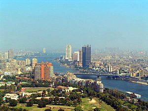
Aerial view looking south, with the Zamalek and Gezira districts on Gezira Island, surrounded by the Nile
-
View of the Nile and the Cairo skyline.
-
Cairo University is the largest university in Egypt, and is located in Giza.
-
Cairo International Stadium with 75,100 seats
See also
 In Spanish: El Cairo para niños


