Burns Junction, Oregon facts for kids
Quick facts for kids
Burns Junction
|
|
|---|---|
 |
|
| Country | United States |
| State | Oregon |
| County | Malheur |
| Elevation | 3,934 ft (1,199 m) |
| Time zone | UTC-7 (Mountain) |
| • Summer (DST) | UTC-6 (MDT) |
| ZIP codes |
97910
|
| Area code(s) | 541 |
| Coordinates and elevation from United States Geological Survey | |
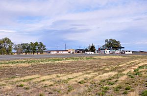
Burns Junction is an unincorporated community located in Malheur County, Oregon, United States, situated at the intersection of U.S. Route 95 and Oregon Route 78, it lies approximately 80 miles (130 km) southeast of the Harney County city of Burns.
Climate
According to the Köppen Climate Classification system, Burns Junction has a semi-arid climate, abbreviated "BSk" on climate maps.
Education
The community is in Arock School District 81, based in Arock.

All content from Kiddle encyclopedia articles (including the article images and facts) can be freely used under Attribution-ShareAlike license, unless stated otherwise. Cite this article:
Burns Junction, Oregon Facts for Kids. Kiddle Encyclopedia.


