Bundure, New South Wales facts for kids
Quick facts for kids BundureNew South Wales |
|
|---|---|

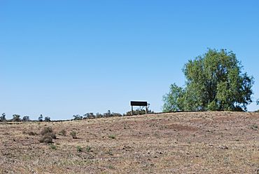
Disused rail siding at Bundure
|
|
| Population | 274 (2006 census) |
| Postcode(s) | 2663 |
| Elevation | 109 m (358 ft) |
| Location |
|
| LGA(s) | Murrumbidgee Council |
| County | Urana |
| State electorate(s) | Albury |
| Federal Division(s) | Farrer |
Bundure is a rural community in the central south part of the Riverina. It is situated by road, about 25 kilometres south west of Widgiewa and 33 kilometres north east of Jerilderie. In 2006, Bundure had a population of 274 people.
The place name Bundure is derived from the local Aboriginal word Bundoora meaning "place of meeting of many Kangaroos".
Bundure Post Office opened on 1 September 1926, was closed between 1930 and 1934, and finally closed in 1973.

All content from Kiddle encyclopedia articles (including the article images and facts) can be freely used under Attribution-ShareAlike license, unless stated otherwise. Cite this article:
Bundure, New South Wales Facts for Kids. Kiddle Encyclopedia.

