Brusett, Montana facts for kids
Quick facts for kids
Brusett, Montana
|
|
|---|---|
| Country | United States |
| State | Montana |
| County | Garfield |
| Elevation | 2,904 ft (885 m) |
| Time zone | UTC-7 (Mountain (MST)) |
| • Summer (DST) | UTC-6 (MDT) |
| ZIP codes |
59318
|
| GNIS feature ID | 802064 |
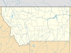
Brusett is an unincorporated tiny rural hamlet in northwestern Garfield County, Montana, United States. It lies about the intersection of Brusett Road and Edwards Road, local roads west of the town of Jordan, the county seat of Garfield County. Its elevation is 2,904 feet (885 m). It has a post office, serving the ZIP code of 59318, and a small school house; and no other businesses or services.
History
The post office opened on May 29, 1916. The town was named for its first postmaster, Alma Brusett Smith.
Climate
According to the Köppen Climate Classification system, Brusett has a semi-arid climate, abbreviated "BSk" on climate maps.

All content from Kiddle encyclopedia articles (including the article images and facts) can be freely used under Attribution-ShareAlike license, unless stated otherwise. Cite this article:
Brusett, Montana Facts for Kids. Kiddle Encyclopedia.


