Braefield, New South Wales facts for kids
Quick facts for kids BraefieldNew South Wales |
|||||||||||||||
|---|---|---|---|---|---|---|---|---|---|---|---|---|---|---|---|

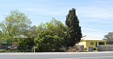
Houses fronting the Kamilaroi Highway at Braefield
|
|||||||||||||||
| Population | 62 (2016 census) | ||||||||||||||
| Postcode(s) | 2339 | ||||||||||||||
| Elevation | 388 m (1,273 ft) | ||||||||||||||
| Location | |||||||||||||||
| LGA(s) | Liverpool Plains Shire | ||||||||||||||
| Region | North West Slopes | ||||||||||||||
| County | Buckland | ||||||||||||||
| Parish | Quirindi | ||||||||||||||
| State electorate(s) | Upper Hunter | ||||||||||||||
| Federal Division(s) | New England | ||||||||||||||
|
|||||||||||||||
Braefield is a locality on the Main North railway line and Kamilaroi Highway in northern New South Wales, Australia. The station opened in 1878, and no trace now remains.
Black History Month on Kiddle
African-American female entrepreneurs
 | Madam C. J. Walker |
 | Janet Emerson Bashen |
 | Annie Turnbo Malone |
 | Maggie L. Walker |

All content from Kiddle encyclopedia articles (including the article images and facts) can be freely used under Attribution-ShareAlike license, unless stated otherwise. Cite this article:
Braefield, New South Wales Facts for Kids. Kiddle Encyclopedia.
