Bowman-Haley Dam facts for kids
Quick facts for kids Bowman-Haley Dam |
|
|---|---|
 |
|
|
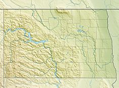
Location of Bowman-Haley Dam in North Dakota
|
|
| Country | United States |
| Location | Bowman County, North Dakota |
| Coordinates | 45°59′00″N 103°14′42″W / 45.9833°N 103.2450°W |
| Status | Operational |
| Opening date | 1970 |
| Owner(s) | |
| Dam and spillways | |
| Type of dam | Embankment |
| Impounds | North Fork of the Grand River |
| Height | 79 ft (24 m) |
| Length | 5,730 ft (1,747 m) |
| Reservoir | |
| Creates | Bowman-Haley Reservoir |
| Total capacity | 171,838 acre⋅ft (0.211959 km3) (Maximum Pool) |
| Active capacity | 19,780 acre⋅ft (0.02440 km3) (Normal Pool) |
| Surface area | 2.7 square miles |
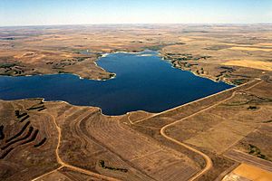
Bowman-Haley Dam is an embankment dam located in Bowman County, North Dakota, in the southwestern part of the state. The dam is just over 2 miles north of the South Dakota border.
The earthen dam was constructed in 1970 by the United States Army Corps of Engineers to impound the North Fork of the Grand River for flood control, fish and wildlife preservation, recreation, and municipal and industrial water supply. The dam is owned and operated by the Corps of Engineers, with a height of 79 feet and a length of 5730 at its crest.
The reservoir it creates, Bowman-Haley Lake, has a water surface of 2.7 square miles and a maximum capacity of 171,838 acre-feet, although its normal storage level of 19,780 acre-feet is much smaller.

All content from Kiddle encyclopedia articles (including the article images and facts) can be freely used under Attribution-ShareAlike license, unless stated otherwise. Cite this article:
Bowman-Haley Dam Facts for Kids. Kiddle Encyclopedia.

