Bouvet Island facts for kids
 |
|
 |
|
| Geography | |
|---|---|
| Location | South-Atlantic Ocean |
| Coordinates | 54°26′S 3°24′E / 54.433°S 3.400°E |
| Administration | |
|
Norway
|
|
| Demographics | |
| Population | 0 |
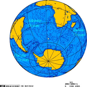
Bouvet Island (Norwegian: Bouvetøya, also historically known as Liverpool Island or Lindsay Island) is an island in the southern part of the Atlantic Ocean. It is in the sub-antarctic areas, 2500 km (1500 miles) south-southwest of the Cape of Good Hope (South Africa).
It belongs to Norway and is not subject to the Antarctic Treaty (which says that land south of 60°S, including Antarctica, do not belong to any country). It is the most remote island in the world, which means that is farther from other land than any other island on Earth. The closest piece of land to the island is Queen Maud Land in Antarctica, which is more than 1600 km (994 miles) away. Nobody lives there, and there are rarely any visitors.
Geography
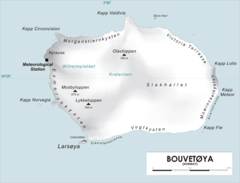
The island is volcanic and has high cliffs on all sides (created by high waves over thousands of years). 90% of its area is covered by glaciers (ice).
History
In January 2015 a new research station was put into place, for use by research expeditions.
Climate, plants and animal life
The climate is cold and does not change much, with an average of +1 °C in the warmest month, and −3 °C in the coldest.
There are penguins, sea birds and seals on the island.
Images for kids
-
NASA image of Bouvet Island from space
See also
 In Spanish: Isla Bouvet para niños


