Blue Creek (Gunnison River tributary) facts for kids
Quick facts for kids Blue Creek |
|
|---|---|

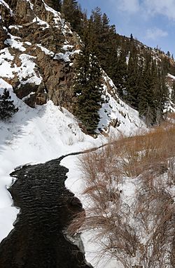
The headwaters of Blue Creek in Blue Creek Canyon along U.S. Highway 50 in Gunnison County, Colorado
|
|
|
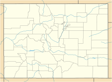
The creek's location in Colorado
|
|
| Physical characteristics | |
| Main source | Blue Creek Canyon 38°02′31″N 107°24′16″W / 38.04194°N 107.40444°W |
| River mouth | Morrow Point Reservoir (Gunnison River) 7,949 feet (2,423 meters) 38°27′02″N 107°27′16″W / 38.45056°N 107.45444°W |
| Length | 3.5 miles (5.6 kilometers) long. |
| Basin features | |
| Progression | Gunnison River—Colorado River |
Blue Creek is a tributary of the Gunnison River in Gunnison County, Colorado. It forms at the confluence of Little Blue Creek and Big Blue Creek adjacent to the intersection of U.S. Highway 50 and Alpine Plateau Road (Gunnison County Road 867) in Blue Creek Canyon.
Course
After it starts at the confluence of little Blue Creek and Big Blue Creek, Blue Creek flows under a bridge on Highway 50, it then flows north along the highway's west side, and then separates from the highway heading north until it eventually empties into Morrow Point Reservoir at the Curecanti Needle. The creek is 3.5 miles (5.6 kilometers) long.
Other
Blue Creek is one of the two primary stream inflows to Morrow Point Reservoir (the other one is Curecanti Creek). Its mouth lies within the Curecanti National Recreation Area. The portion of the stream within the recreation area has good fly fishing and provides the best chance of catching fish, but access here is only by boat.


