Bijou Hills, South Dakota facts for kids
Quick facts for kids
Bijou Hills, South Dakota
|
|
|---|---|
| Country | United States |
| State | South Dakota |
| Counties | Brule |
| Area | |
| • Total | 5.25 sq mi (13.60 km2) |
| • Land | 5.25 sq mi (13.60 km2) |
| • Water | 0.00 sq mi (0.00 km2) |
| Elevation | 1,811 ft (552 m) |
| Population
(2020)
|
|
| • Total | 2 |
| • Density | 0.38/sq mi (0.15/km2) |
| Time zone | UTC-6 (Central (CST)) |
| • Summer (DST) | UTC-5 (CDT) |
| FIPS code | 46-05580 |
| GNIS feature ID | 2584546 |
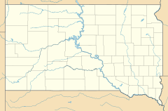
Bijou Hills (Lakota: Wíyukeze Pahá) is an unincorporated community and census-designated place in Brule County, South Dakota, United States. As of 2020 census, The population was 2, down from 6 in 2010.
The CDP is located in southern Brule County, at the south base of a small ridge known as the Bijou Hills. The community is 1.2 miles (1.9 km) northeast of South Dakota Highway 50 and 18 miles (29 km) south of Interstate 90.
History
Bijou Hills was laid out in 1875, and named after a nearby group of hills. A post office called Bijou Hills was established in 1877, and remained in operation until 1957.
In 1976, Bijou Hills was designated as a National Natural Landmark by the National Park Service.
Demographics
| Historical population | |||
|---|---|---|---|
| Census | Pop. | %± | |
| 2010 | 6 | — | |
| 2020 | 2 | −66.7% | |
| U.S. Decennial Census | |||
See also
 In Spanish: Bijou Hills para niños

All content from Kiddle encyclopedia articles (including the article images and facts) can be freely used under Attribution-ShareAlike license, unless stated otherwise. Cite this article:
Bijou Hills, South Dakota Facts for Kids. Kiddle Encyclopedia.

