Big Sandy, West Virginia facts for kids
Quick facts for kids
Big Sandy
|
|
|---|---|
|
Census-designated place (CDP)
|
|

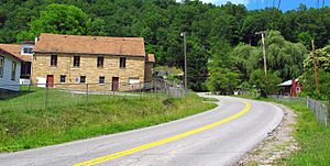
Davy Roderfield Road in Big Sandy
|
|
| Country | United States |
| State | West Virginia |
| County | McDowell |
| Area | |
| • Total | 0.553 sq mi (1.43 km2) |
| • Land | 0.532 sq mi (1.38 km2) |
| • Water | 0.021 sq mi (0.05 km2) |
| Population
(2010)
|
|
| • Total | 168 |
| • Density | 303.8/sq mi (117.3/km2) |
| Time zone | UTC-5 (Eastern (EST)) |
| • Summer (DST) | UTC-4 (EDT) |
Big Sandy is a census-designated place (CDP) located in McDowell County, West Virginia, United States. As of the 2010 census, its population is 168. The town's name comes from the Big Sandy River, a major tributary of the Ohio River which forms the boundary between West Virginia and Kentucky.
See also
 In Spanish: Big Sandy (Virginia Occidental) para niños

All content from Kiddle encyclopedia articles (including the article images and facts) can be freely used under Attribution-ShareAlike license, unless stated otherwise. Cite this article:
Big Sandy, West Virginia Facts for Kids. Kiddle Encyclopedia.

