Bentley, Oklahoma facts for kids
Quick facts for kids
Bentley
|
|
|---|---|
| Country | United States |
| State | Oklahoma |
| County | Atoka |
| Area | |
| • Total | 0.34 sq mi (0.88 km2) |
| • Land | 0.34 sq mi (0.88 km2) |
| • Water | 0.00 sq mi (0.00 km2) |
| Elevation | 581 ft (177 m) |
| Population
(2020)
|
|
| • Total | 42 |
| • Density | 124.26/sq mi (47.91/km2) |
| Time zone | UTC-6 (Central (CST)) |
| • Summer (DST) | UTC-5 (CDT) |
| FIPS code | 40-05450 |
| GNIS feature ID | 2805306 |
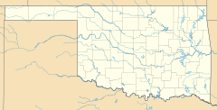
Bentley is an unincorporated community in Atoka County, Oklahoma, United States. It lies east of the county seat of Atoka, off Highway 3.
A post office was established at Bentley, Indian Territory on June 1, 1903. It was named for Alva Bentley, a territorial-era educator. At the time of its founding, the community was located in Atoka County, Choctaw Nation.
There was once a school at Bentley, but it has closed down. Its post office closed on August 30, 1963.
On the main street of Bentley, there is a fire department, community center and a Southern Baptist Church.
Demographics
| Historical population | |||
|---|---|---|---|
| Census | Pop. | %± | |
| 2020 | 42 | — | |
| U.S. Decennial Census | |||

All content from Kiddle encyclopedia articles (including the article images and facts) can be freely used under Attribution-ShareAlike license, unless stated otherwise. Cite this article:
Bentley, Oklahoma Facts for Kids. Kiddle Encyclopedia.


