Belwood, North Carolina facts for kids
Quick facts for kids
Belwood, North Carolina
|
|
|---|---|

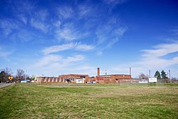
Belwood Community Center
|
|

Location of Belwood, North Carolina
|
|
| Country | United States |
| State | North Carolina |
| County | Cleveland |
| Area | |
| • Total | 12.30 sq mi (31.87 km2) |
| • Land | 12.30 sq mi (31.85 km2) |
| • Water | 0.01 sq mi (0.02 km2) |
| Elevation | 1,020 ft (310 m) |
| Population
(2020)
|
|
| • Total | 857 |
| • Density | 69.69/sq mi (26.91/km2) |
| Time zone | UTC-5 (Eastern (EST)) |
| • Summer (DST) | UTC-4 (EDT) |
| ZIP code |
28090
|
| Area code(s) | 704 |
| FIPS code | 37-04960 |
| GNIS feature ID | 2405239 |
Belwood is a town in Cleveland County, North Carolina, United States. The population was 950 at the 2010 census.
Contents
History
Belwood was incorporated in 1978. The name of the town means "beautiful woods."
Geography
Belwood is located in northeastern Cleveland County. The northeast border of the town follows the county line, with Lincoln County to the east.
North Carolina Highway 18 (Fallston Road) passes through the town, leading south 14 miles (23 km) to Shelby, the county seat, and north 25 miles (40 km) to Morganton.
According to the United States Census Bureau, Belwood has a total area of 12.3 square miles (31.9 km2), of which 0.008 square miles (0.02 km2), or 0.05%, is water.
Demographics
| Historical population | |||
|---|---|---|---|
| Census | Pop. | %± | |
| 1980 | 613 | — | |
| 1990 | 631 | 2.9% | |
| 2000 | 962 | 52.5% | |
| 2010 | 950 | −1.2% | |
| 2020 | 857 | −9.8% | |
| U.S. Decennial Census | |||
2020 census
| Race | Number | Percentage |
|---|---|---|
| White (non-Hispanic) | 777 | 90.67% |
| Black or African American (non-Hispanic) | 17 | 1.98% |
| Native American | 2 | 0.23% |
| Asian | 2 | 0.23% |
| Pacific Islander | 2 | 0.23% |
| Other/Mixed | 17 | 1.98% |
| Hispanic or Latino | 40 | 4.67% |
As of the 2020 United States census, there were 857 people, 349 households, and 251 families residing in the town.
See also
 In Spanish: Belwood (Carolina del Norte) para niños

