Bearskin Lake (Minnesota) facts for kids
Quick facts for kids Bearskin Lake |
|
|---|---|
| West Bearskin Lake, Birch Lake, Muko-waiani | |
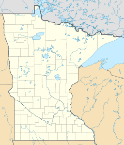
| Location | Cook County, Minnesota |
| Group | Boundary Waters Canoe Area |
| Coordinates | 48°03′58″N 90°25′36″W / 48.066°N 90.426765°W |
| Type | oligotrophic, glacial |
| Basin countries | United States |
| Surface area | 493 acres (200 ha) |
| Average depth | 31 ft (9.4 m) |
| Max. depth | 78 ft (24 m) |
| Residence time | 17 years |
Bearskin Lake is an oligotrophic glacial lake near the Boundary Waters Canoe Area (BWCA) in Minnesota, United States. The name Bearskin Lake is an English translation of the Ojibwe-language name Muko-waiani. Bearskin Lake is a source of control sediment for US federal sediment toxicity studies. Bearskin Lake is home to Camp Menogyn, a YMCA camp only accessible by boat.
Sediments and scientific significance
Due to the cleanliness of the lake and the physical attributes of its sediment, Bearskin Lake sediment is ideal for sediment toxicity testing. Bearskin Lake sediment is used as a control sediment in the federal government's toxicity tests and was used to develop the US EPA's toxicity testing methods.

All content from Kiddle encyclopedia articles (including the article images and facts) can be freely used under Attribution-ShareAlike license, unless stated otherwise. Cite this article:
Bearskin Lake (Minnesota) Facts for Kids. Kiddle Encyclopedia.

