Bayview Heights, Queensland facts for kids
Quick facts for kids Bayview HeightsQueensland |
|||||||||||||||
|---|---|---|---|---|---|---|---|---|---|---|---|---|---|---|---|

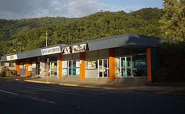
Marti Street, Bayview Heights
|
|||||||||||||||
| Population | 4,175 (2021 census) | ||||||||||||||
| • Density | 971/km2 (2,510/sq mi) | ||||||||||||||
| Postcode(s) | 4868 | ||||||||||||||
| Area | 4.3 km2 (1.7 sq mi) | ||||||||||||||
| Location |
|
||||||||||||||
| LGA(s) | Cairns Region | ||||||||||||||
| State electorate(s) | Mulgrave | ||||||||||||||
| Federal Division(s) | Leichhardt | ||||||||||||||
|
|||||||||||||||
Bayview Heights is a southern suburb of Cairns in the Cairns Region, Queensland, Australia. In the 2021 census, Bayview Heights had a population of 4,175 people.
Contents
History
Bayview Heights is situated in the Yidinji traditional Aboriginal country. The area was aptly named Bayview in 1947 based on views of the sea. The name Bayview Heights was implemented in April 1970.
Demographics
In the 2011 census, Bayview Heights had a population of 4,150 people.
In the 2016 census, Bayview Heights had a population of 4,238 people.
In the 2021 census, Bayview Heights had a population of 4,175 people.
Education
There are no schools in Bayview Heights. The nearest government primary and secondary schools are Woree State School and Woree State High School, both in the neighbouring suburb of Woree to the west.
See also
 In Spanish: Bayview Heights (Queensland) para niños


