Bayou Macon facts for kids
Quick facts for kids Bayou Macon |
|
|---|---|

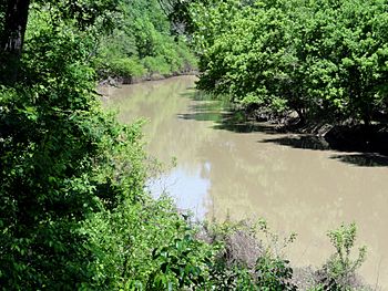
Bayou Macon as seen from Poverty Point Reservoir State Park
|
|

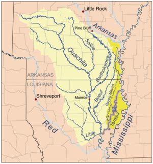
Map of the Tensas River Basin, including Bayou Macon
|
|
| Country | United States |
| States | Arkansas, Louisiana |
| Physical characteristics | |
| Main source | Desha County, Arkansas 33°46′15″N 91°26′15″W / 33.77094°N 91.43762°W |
| River mouth | Confluence with the Tensas River Catahoula Parish, Louisiana 31°54′49″N 91°32′52″W / 31.91349°N 91.54790°W |
| Length | 218 mi (351 km) |
Bayou Macon is a bayou in Arkansas and Louisiana. It begins in Desha County, Arkansas, and flows south, between the Boeuf River to its west and the Mississippi River to its east, before joining Joe's Bayou south of Delhi in Richland Parish, Louisiana. Bayou Macon is about 218 miles (351 km) long.
The bayou area saw action during the American Civil War including from the 1st Regiment Kansas Volunteer Infantry in May 1863 in the areas then known as Caledonia and Pin Hook.

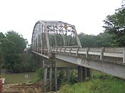
This 1962 bridge over Bayou Macon (2013 photograph) between East and West Carroll Parish in northeastern Louisiana was replaced effective March 24, 2014 with a new structure valued at $4.6 million. Some seven hundred vehicles on Louisiana Highway 134 cross the bridge daily. Governor Bobby Jindal came to West Carroll Parish for the bridge dedication.
The Bayou Macon Wildlife Management Area comprises 6,919 acres in East Carroll Parish and was acquired by the Louisiana Department of Wildlife and Fisheries in 1991.

All content from Kiddle encyclopedia articles (including the article images and facts) can be freely used under Attribution-ShareAlike license, unless stated otherwise. Cite this article:
Bayou Macon Facts for Kids. Kiddle Encyclopedia.
